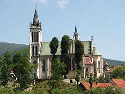
Mszana Dolna [ˈmʂana ˈdɔlna] is a town in Limanowa County, Lesser Poland Voivodeship, Poland, with 7,431 inhabitants (2004). Mszana Dolna lies among the hills of western Beskids, 50 kilometres (31 miles) south of Kraków. The town is located in a deep valley, surrounded by several ranges, including the Gorce Mountains featuring Gorce National Park. Mszana is located along National Road Nr. 28, which goes west - east, from Zator to Przemyśl. In 2002, the area of Mszana Dolna was 27.1 square kilometres (10.5 sq mi), out of which forests covered 50%, and arable land 36%.
Mszana Dolna was first mentioned in 1365. It received its Magdeburg rights some time in the late 14th or early 15th century, and since its inhabitants were mostly German Walddeutsche, the town was called Kinsbark (or Königsberg). Kinsbark lost its town privileges some time in the mid-15th century, and the former town, which had changed its name into Mieścisko, was in 1464 merged with the village of Mszany. The village was completely burned in the Swedish invasion of Poland (1655 - 1660). Until the first partition of Poland (1772), Mszana belonged to Kraków Voivodeship, and in 1772 it was annexed by the Habsburg Empire, as part of the province of Galicia.
In 1918 Mszana returned to Poland, and in early September 1939, 10th Armoured Cavalry Brigade of General Stanisław Maczek fought here against the advancing Wehrmacht. During World War II, Mszana lost one-third of its population, including its Jewish residents, of whom 881 were murdered by the Germans on August 19, 1943. In 1952 Mszana Dolna regained its town rights. Currently, it is an important tourist center, with hotels, restaurants and several tourist trails marked with different colors, leading into the mountains.
Nearby municipalities
See also
External links
|
|---|
| | Seat (not part of the gmina) | | |
|---|
| | Villages | |
|---|
|
Coordinates: 49°40′32″N 20°04′30″E / 49.67556°N 20.07500°E / 49.67556; 20.07500


