Mosquito Creek (Iowa)
From Wikipedia, the free encyclopedia
| Mosquito Creek | |
| River | |
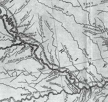
 This excerpt from the Lewis and Clark map of 1814 shows the rivers of southwest Iowa, southeast Nebraska, and northwest Missouri. "Musquito River" is seen at the upper left. | |
| Country | US |
|---|---|
| State | Iowa |
| Source | |
| - coordinates | 41°48′18″N 95°22′44″W / 41.805°N 95.379°W |
| Mouth | |
| - coordinates | 41°10′34″N 95°50′25″W / 41.176°N 95.8402°W |
Mosquito Creek, about 60 mi. (97 km) long, is a tributary of the Missouri River in southwest Iowa in the United States. It rises near Earling, in Shelby County, and flows in a generally southwesterly direction, meeting the Missouri approximately 5 mi. (8 km) downstream of Council Bluffs.
See also
- List of Iowa rivers
External links
This article is issued from Wikipedia. The text is available under the Creative Commons Attribution/Share Alike; additional terms may apply for the media files.