Montville, Ohio
From Wikipedia, the free encyclopedia
| Montville, Ohio | |
|---|---|
| Unincorporated community | |
 | |
| Coordinates: 41°36′26″N 81°03′01″W / 41.60722°N 81.05028°WCoordinates: 41°36′26″N 81°03′01″W / 41.60722°N 81.05028°W | |
| Country | United States |
| State | Ohio |
| County | Geauga |
| Township | Montville |
| Time zone | Eastern (EST) (UTC-5) |
| • Summer (DST) | EDT (UTC-4) |
| ZIP codes | 44064 |
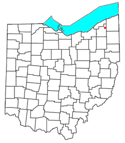
Montville is an unincorporated community in central Montville Township, Geauga County, Ohio, United States. Although it is unincorporated, it has a post office, with the ZIP code of 44064.[1] It lies at the intersection of U.S. Route 6 with State Route 528.
References
| ||||||||||||||||||||||||||

This article is issued from Wikipedia. The text is available under the Creative Commons Attribution/Share Alike; additional terms may apply for the media files.