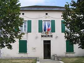
Montjean, Charente
From Wikipedia, the free encyclopedia
| Montjean | |
|---|---|
 | |
 Montjean | |
|
Location within Poitou-Charentes region  Montjean | |
| Coordinates: 46°05′18″N 0°07′14″E / 46.0883°N 0.1206°ECoordinates: 46°05′18″N 0°07′14″E / 46.0883°N 0.1206°E | |
| Country | France |
| Region | Poitou-Charentes |
| Department | Charente |
| Arrondissement | Confolens |
| Canton | Villefagnan |
| Intercommunality | Pays de Villefagnan |
| Government | |
| • Mayor (2008–2014) | Jean-Louis Caillet |
| Area | |
| • Land1 | 8.01 km2 (3.09 sq mi) |
| Population (2008) | |
| • Population2 | 261 |
| • Population2 Density | 33/km2 (84/sq mi) |
| INSEE/Postal code | 16229 / 16240 |
| Elevation |
113–149 m (371–489 ft) (avg. 157 m or 515 ft) |
|
1 French Land Register data, which excludes lakes, ponds, glaciers > 1 km² (0.386 sq mi or 247 acres) and river estuaries. 2 Population without double counting: residents of multiple communes (e.g., students and military personnel) only counted once. | |
Montjean is a commune in the Charente department in southwestern France.
Population
| Historical population | ||
|---|---|---|
| Year | Pop. | ±% |
| 1793 | 614 | — |
| 1800 | 627 | +2.1% |
| 1806 | 663 | +5.7% |
| 1821 | 641 | −3.3% |
| 1831 | 660 | +3.0% |
| 1841 | 688 | +4.2% |
| 1846 | 700 | +1.7% |
| 1851 | 707 | +1.0% |
| 1856 | 686 | −3.0% |
| 1861 | 660 | −3.8% |
| 1866 | 634 | −3.9% |
| 1872 | 607 | −4.3% |
| 1876 | 571 | −5.9% |
| 1881 | 565 | −1.1% |
| 1886 | 526 | −6.9% |
| 1891 | 513 | −2.5% |
| 1896 | 500 | −2.5% |
| 1901 | 489 | −2.2% |
| 1906 | 467 | −4.5% |
| 1911 | 437 | −6.4% |
| 1921 | 417 | −4.6% |
| 1926 | 411 | −1.4% |
| 1931 | 400 | −2.7% |
| 1936 | 375 | −6.2% |
| 1946 | 340 | −9.3% |
| 1954 | 333 | −2.1% |
| 1962 | 318 | −4.5% |
| 1968 | 322 | +1.3% |
| 1975 | 297 | −7.8% |
| 1982 | 291 | −2.0% |
| 1990 | 272 | −6.5% |
| 1999 | 262 | −3.7% |
| 2008 | 261 | −0.4% |
See also
References
| Wikimedia Commons has media related to Montjean (Charente). |
This article is issued from Wikipedia. The text is available under the Creative Commons Attribution/Share Alike; additional terms may apply for the media files.