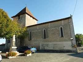
Montignac-le-Coq
From Wikipedia, the free encyclopedia
| Montignac-le-Coq | |
|---|---|
 | |
 Montignac-le-Coq | |
|
Location within Poitou-Charentes region  Montignac-le-Coq | |
| Coordinates: 45°20′15″N 0°13′26″E / 45.3375°N 0.2239°ECoordinates: 45°20′15″N 0°13′26″E / 45.3375°N 0.2239°E | |
| Country | France |
| Region | Poitou-Charentes |
| Department | Charente |
| Arrondissement | Angoulême |
| Canton | Aubeterre-sur-Dronne |
| Intercommunality | Pays d'Aubeterre |
| Government | |
| • Mayor (2008–2014) | Alain Désert |
| Area | |
| • Land1 | 10.2 km2 (3.9 sq mi) |
| Population (2008) | |
| • Population2 | 135 |
| • Population2 Density | 13/km2 (34/sq mi) |
| INSEE/Postal code | 16227 / 16390 |
| Elevation |
62–191 m (203–627 ft) (avg. 130 m or 430 ft) |
|
1 French Land Register data, which excludes lakes, ponds, glaciers > 1 km² (0.386 sq mi or 247 acres) and river estuaries. 2 Population without double counting: residents of multiple communes (e.g., students and military personnel) only counted once. | |
Montignac-le-Coq is a commune in the Charente department in southwestern France.
Population
| Historical population | ||
|---|---|---|
| Year | Pop. | ±% |
| 1793 | 625 | — |
| 1800 | 634 | +1.4% |
| 1806 | 620 | −2.2% |
| 1821 | 530 | −14.5% |
| 1831 | 552 | +4.2% |
| 1841 | 572 | +3.6% |
| 1846 | 551 | −3.7% |
| 1851 | 563 | +2.2% |
| 1856 | 561 | −0.4% |
| 1861 | 600 | +7.0% |
| 1866 | 557 | −7.2% |
| 1872 | 514 | −7.7% |
| 1876 | 532 | +3.5% |
| 1881 | 515 | −3.2% |
| 1886 | 505 | −1.9% |
| 1891 | 392 | −22.4% |
| 1896 | 383 | −2.3% |
| 1901 | 334 | −12.8% |
| 1906 | 342 | +2.4% |
| 1911 | 320 | −6.4% |
| 1921 | 319 | −0.3% |
| 1926 | 291 | −8.8% |
| 1931 | 290 | −0.3% |
| 1936 | 303 | +4.5% |
| 1946 | 301 | −0.7% |
| 1954 | 261 | −13.3% |
| 1962 | 252 | −3.4% |
| 1968 | 251 | −0.4% |
| 1975 | 224 | −10.8% |
| 1982 | 209 | −6.7% |
| 1990 | 162 | −22.5% |
| 1999 | 150 | −7.4% |
| 2008 | 135 | −10.0% |
See also
References
| Wikimedia Commons has media related to Montignac-le-Coq. |
This article is issued from Wikipedia. The text is available under the Creative Commons Attribution/Share Alike; additional terms may apply for the media files.