Montescudo
From Wikipedia, the free encyclopedia
| Montescudo | ||
|---|---|---|
| Comune | ||
| Comune di Montescudo | ||
 | ||
| ||
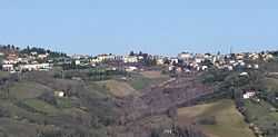
 Montescudo | ||
| Coordinates: 43°55′N 12°33′E / 43.917°N 12.550°E | ||
| Country | Italy | |
| Region | Emilia-Romagna | |
| Province | Rimini (RN) | |
| Frazioni | Albereto, Santa Maria del Piano, Trarivi | |
| Government | ||
| • Mayor | Andrea Pula | |
| Area | ||
| • Total | 19.9 km2 (7.7 sq mi) | |
| Elevation | 386 m (1,266 ft) | |
| Population (31 May 2007) | ||
| • Total | 2,841 | |
| • Density | 140/km2 (370/sq mi) | |
| Demonym | Montescudesi | |
| Time zone | CET (UTC+1) | |
| • Summer (DST) | CEST (UTC+2) | |
| Postal code | 47040 | |
| Dialing code | 0541 | |
| Patron saint | St. Sebastian | |
| Saint day | January 20 | |
| Website | Official website | |

Montescudo is a comune (municipality) in the Province of Rimini in the Italian region Emilia-Romagna, located about 120 km southeast of Bologna and about 15 km south of Rimini.
Montescudo borders the following municipalities: Coriano, Faetano (San Marino), Gemmano, Monte Colombo, Sassofeltrio.
History
Montescudo's is most likely of Etruscan origin. In the Roman era it was a station of the military mail service from Rimini to Rome. In 1209 it was conquered by Emperor Otto I, and later was under the Republic of Venice. In the late Middle Ages, through a series of bloody struggles, it was contended by the House of Malatesta of Rimini and by the Dukes of Urbino. In 1509 it was ceded by the Republic of Venice to the Papal States.
Main sights
- Civic Tower (14th century)
- Remains of the walls erected by Sigismondo Pandolfo Malatesta, as well as of a Rocca Malatestiana (castle).
- The Ghiacciaia, an ice reservoir dating from the Malatestian era.
- Remains of the 15th century church of Santa Maria Succurrente, in the frazione of Valliano.
References
External links
This article is issued from Wikipedia. The text is available under the Creative Commons Attribution/Share Alike; additional terms may apply for the media files.