Montemor-o-Novo Municipality
From Wikipedia, the free encyclopedia
| Montemor-o-Novo | |||
|---|---|---|---|
| Municipality | |||
| |||
 | |||
| Coordinates: 38°39′N 8°13′W / 38.650°N 8.217°WCoordinates: 38°39′N 8°13′W / 38.650°N 8.217°W | |||
| Country |
| ||
| Region | Alentejo | ||
| Subregion | Alentejo Central | ||
| District/A.R. | Évora | ||
| Government | |||
| • Mayor | Carlos Sá (CDU) | ||
| Area | |||
| • Total | 1,232.9 km2 (476.0 sq mi) | ||
| Population | |||
| • Total | 18,540 | ||
| • Density | 15/km2 (40/sq mi) | ||
| Parishes (no.) | 10 | ||
| Municipal holiday |
Saint John of God March 8 | ||
| Website | http://www.cm-montemornovo.pt | ||
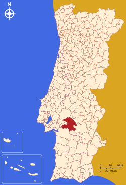
Montemor-o-Novo (Portuguese pronunciation: [mõtɨˈmɔɾ u ˈnovu]) is a municipality in Portugal with a total area of 1233.0 km² and a total population of 18,485 inhabitants. The city itself has a population of 12,000.[1]
The municipality is composed of 10 parishes, and is located in the District of Évora.
The present Mayor is Carlos Manuel Pinto Sá, elected by the Unitarian Democratic Coalition.
The municipal holiday is March 8, after Saint John of God, a 16th-century saint, who was born in Montemor-o-Novo.
Parishes
- Cabrela
- Ciborro
- Cortiçadas
- Foros de Vale de Figueira
- Lavre
- Nossa Senhora da Vila
- Nossa Senhora do Bispo
- Santiago do Escoural
- São Cristóvão
- Silveiras
-

The city castle.
-

Town square.
-

The local landscape.
References
- ↑ UMA POPULAÇÃO QUE SE URBANIZA, Uma avaliação recente - Cidades, 2004 Nuno Pires Soares, Instituto Geográfico Português (Geographic Institute of Portugal)
External links
| |||||
This article is issued from Wikipedia. The text is available under the Creative Commons Attribution/Share Alike; additional terms may apply for the media files.

