Montembœuf
From Wikipedia, the free encyclopedia
| Montembœuf | |
|---|---|
 | |
 Montembœuf | |
|
Location within Poitou-Charentes region  Montembœuf | |
| Coordinates: 45°46′44″N 0°33′12″E / 45.7789°N 0.5533°ECoordinates: 45°46′44″N 0°33′12″E / 45.7789°N 0.5533°E | |
| Country | France |
| Region | Poitou-Charentes |
| Department | Charente |
| Arrondissement | Confolens |
| Canton | Montembœuf |
| Intercommunality | Haute-Charente |
| Government | |
| • Mayor (2008–2014) | Domonique Chevreuse |
| Area | |
| • Land1 | 16.05 km2 (6.20 sq mi) |
| Population (2008) | |
| • Population2 | 698 |
| • Population2 Density | 43/km2 (110/sq mi) |
| INSEE/Postal code | 16225 / 16310 |
| Elevation |
181–342 m (594–1,122 ft) (avg. 270 m or 890 ft) |
|
1 French Land Register data, which excludes lakes, ponds, glaciers > 1 km² (0.386 sq mi or 247 acres) and river estuaries. 2 Population without double counting: residents of multiple communes (e.g., students and military personnel) only counted once. | |
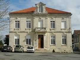
Montembœuf is a commune in the Charente department in southwestern France.
Population
| Historical population | ||
|---|---|---|
| Year | Pop. | ±% |
| 1793 | 1,072 | — |
| 1800 | 947 | −11.7% |
| 1806 | 1,161 | +22.6% |
| 1821 | 1,149 | −1.0% |
| 1831 | 1,257 | +9.4% |
| 1841 | 1,262 | +0.4% |
| 1846 | 1,278 | +1.3% |
| 1851 | 1,347 | +5.4% |
| 1856 | 1,258 | −6.6% |
| 1861 | 1,246 | −1.0% |
| 1866 | 1,307 | +4.9% |
| 1872 | 1,224 | −6.4% |
| 1876 | 1,306 | +6.7% |
| 1881 | 1,281 | −1.9% |
| 1886 | 1,330 | +3.8% |
| 1891 | 1,240 | −6.8% |
| 1896 | 1,227 | −1.0% |
| 1901 | 1,258 | +2.5% |
| 1906 | 1,230 | −2.2% |
| 1911 | 1,276 | +3.7% |
| 1921 | 1,063 | −16.7% |
| 1926 | 1,046 | −1.6% |
| 1931 | 966 | −7.6% |
| 1936 | 904 | −6.4% |
| 1946 | 904 | +0.0% |
| 1954 | 796 | −11.9% |
| 1962 | 777 | −2.4% |
| 1968 | 756 | −2.7% |
| 1975 | 676 | −10.6% |
| 1982 | 701 | +3.7% |
| 1990 | 708 | +1.0% |
| 1999 | 669 | −5.5% |
| 2008 | 698 | +4.3% |
See also
References
| Wikimedia Commons has media related to Montembœuf. |
This article is issued from Wikipedia. The text is available under the Creative Commons Attribution/Share Alike; additional terms may apply for the media files.