Montelibretti
From Wikipedia, the free encyclopedia
| Montelibretti | ||
|---|---|---|
| Comune | ||
| Comune di Montelibretti | ||
 | ||
| ||
 Montelibretti | ||
| Coordinates: 42°8′N 12°44′E / 42.133°N 12.733°E | ||
| Country | Italy | |
| Region | Latium | |
| Province | Rome (RM) | |
| Frazioni | Pianabella di Montelibretti, Passo Corese (together with the comune of Fara in Sabina), Borgo Santa Maria, Montemaggiore | |
| Government | ||
| • Mayor | Luigi Sergi | |
| Area | ||
| • Total | 44.0 km2 (17.0 sq mi) | |
| Elevation | 232 m (761 ft) | |
| Population (2008)[1] | ||
| • Total | 5,023 | |
| • Density | 110/km2 (300/sq mi) | |
| Demonym | Montelibrettesi | |
| Time zone | CET (UTC+1) | |
| • Summer (DST) | CEST (UTC+2) | |
| Postal code | 00010 | |
| Dialing code | 0774 | |
| Patron saint | St. Nicholas of Bari, Blessed Virgin of Carmine | |
| Saint day | May 9 and 10, 2nd Saturday in October | |
| Website | Official website | |

Montelibretti is a town and comune (municipality) in the Province of Rome in the Italian region Lazio, located about 30 km northeast of Rome on the slopes of Monti Sabini.
Montelibretti borders the following municipalities: Capena, Fara in Sabina, Fiano Romano, Monterotondo, Montopoli di Sabina, Montorio Romano, Moricone, Nerola, Palombara Sabina.
History
The name derives from the presence of a Roman villa owned by Caius Brutius Presentis, Commodus' father-in-law. In the Middle Ages, starting from the 15th century, it was a fortress of the Orsini, who were succeeded by the Barberini and then by the Sciarra.
In 1867 it was the location of a battle between Garibaldine and Papal troops, in the course of the Battle of Mentana.
Main sights
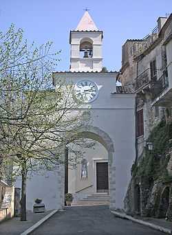
- Parish church of St. Nicholas
- Barberini Palace, built over a castle of the Orsini
- Necropolis of Colle del Forno (7th century BC), attributed to the Sabini town of Eretum
References
This article is issued from Wikipedia. The text is available under the Creative Commons Attribution/Share Alike; additional terms may apply for the media files.