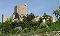
Montefiore Conca
From Wikipedia, the free encyclopedia
| Montefiore Conca | |
|---|---|
| Comune | |
| Comune di Montefiore Conca | |
 | |
 Montefiore Conca | |
| Coordinates: 43°53′N 12°37′E / 43.883°N 12.617°ECoordinates: 43°53′N 12°37′E / 43.883°N 12.617°E | |
| Country | Italy |
| Region | Emilia-Romagna |
| Province | Province of Rimini (RN) |
| Frazioni | san felice, serra di sopra, serra di sotto, la falda, borgo pedrosa, s. gaudenzio, levola |
| Area | |
| • Total | 22.4 km2 (8.6 sq mi) |
| Elevation | 385 m (1,263 ft) |
| Population (Dec. 2004) | |
| • Total | 1,873 |
| • Density | 84/km2 (220/sq mi) |
| Demonym | Montefioresi |
| Time zone | CET (UTC+1) |
| • Summer (DST) | CEST (UTC+2) |
| Postal code | 47834 |
| Dialing code | 0541 |
Montefiore Conca is a comune (municipality) in the Province of Rimini in the Italian region Emilia-Romagna, located about 120 km southeast of Bologna and about 20 km south of Rimini. As of 31 December 2004, it had a population of 1,873 and an area of 22.4 km².[1]
The municipality of Montefiore Conca contains the frazioni (subdivisions, mainly villages and hamlets) san felice, serra di sopra, serra di sotto, la falda, borgo pedrosa, s. gaudenzio, and levola.
Montefiore Conca borders the following municipalities: Auditore, Gemmano, Mondaino, Morciano di Romagna, Saludecio, San Clemente, Tavoleto.
Demographic evolution

References
Gallery

This article is issued from Wikipedia. The text is available under the Creative Commons Attribution/Share Alike; additional terms may apply for the media files.