Monchy-le-Preux
| Monchy-le-Preux | |
|---|---|
 | |
 Monchy-le-Preux | |
|
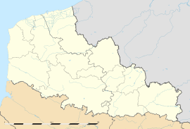
Location within Nord-Pas-de-Calais region  Monchy-le-Preux | |
| Coordinates: 50°16′14″N 2°53′39″E / 50.2706°N 2.8942°ECoordinates: 50°16′14″N 2°53′39″E / 50.2706°N 2.8942°E | |
| Country | France |
| Region | Nord-Pas-de-Calais |
| Department | Pas-de-Calais |
| Arrondissement | Arras |
| Canton | Vitry-en-Artois |
| Intercommunality | Communauté urbaine d'Arras |
| Government | |
| • Mayor (2008–2014) | Michel Zéchel |
| Area | |
| • Land1 | 9.26 km2 (3.58 sq mi) |
| Population (2006) | |
| • Population2 | 518 |
| • Population2 Density | 56/km2 (140/sq mi) |
| INSEE/Postal code | 62582 / 62118 |
| Elevation |
52–113 m (171–371 ft) (avg. 107 m or 351 ft) |
|
1 French Land Register data, which excludes lakes, ponds, glaciers > 1 km² (0.386 sq mi or 247 acres) and river estuaries. 2 Population without double counting: residents of multiple communes (e.g., students and military personnel) only counted once. | |
Monchy-le-Preux is a commune in the Pas-de-Calais department in the Nord-Pas-de-Calais region of France.
Geography
Monchy-le-Preux is situated 6 miles (10 km) southeast of Arras, at the junction of the D33 and the D339 roads. Junction 15 of the A1 autoroute is just a mile away.
History
Monchy was an important strategic position near to Arras during the 1914-18 war and bloody fighting ensued around the village. It was from here that the Germans bombarded Arras and destroyed the belltower. Just outside Monchy, on the D939, a carved Vauthier Stone marks the boundary of the advancing German army during the First World War.
Population
| 1962 | 1968 | 1975 | 1982 | 1990 | 1999 | 2006 |
|---|---|---|---|---|---|---|
| 437 | 465 | 423 | 455 | 487 | 521 | 518 |
| Census count starting from 1962: Population without duplicates | ||||||
Places of interest
- The Commonwealth War Graves Commission cemetery.
- The church of St.Martin, rebuilt along with much of the village, after World War I.
- Monchy-le-Preux (Newfoundland) Memorial commemorating the sacrifice of the soldiers of the Newfoundland Regiment on the 14th April 1917.
- Two chapels.
- Remains of an old chateau.
-
The caribou monument to the Newfoundland Regiment
-
The commemorative plaque
See also
References
External links
| Wikimedia Commons has media related to Monchy-le-Preux. |

