Molina de Aragón
From Wikipedia, the free encyclopedia
| Molina de Aragón, Spain | |||
|---|---|---|---|
 | |||
| |||
 Molina de Aragón, Spain | |||
| Coordinates: 40°50′46″N 1°53′11″W / 40.84611°N 1.88639°WCoordinates: 40°50′46″N 1°53′11″W / 40.84611°N 1.88639°W | |||
| Country | Spain | ||
| Autonomous community | Castile-La Mancha | ||
| Province | Guadalajara | ||
| Comarca | Señorío de Molina-Alto Tajo | ||
| Government | |||
| • Mayor | David Pascual Herrera | ||
| Area | |||
| • Total | 168.33 km2 (64.99 sq mi) | ||
| Elevation | 1,065 m (3,494 ft) | ||
| Population (2009) | |||
| • Total | 3,671 | ||
| • Density | 22/km2 (56/sq mi) | ||
| Time zone | CET (UTC+1) | ||
| • Summer (DST) | CEST (UTC+2) | ||
| Postal code | 19300 | ||
| Website | Official website | ||

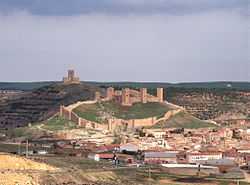
Tower of Aragon.
Molina de Aragón is a municipality located in the province of Guadalajara, Castile-La Mancha, Spain. According to the 2009 census (INE), the municipality has a population of 3,671 inhabitants. It holds the record (−28°C) for the lowest temperature measured by a meteorological station in Spain.[1]
It was the seat of the taifa of Molina, a Moorish independent state, before it was conquered by the Christians of Alfonso I of Aragon in 1129. On 21 April 1154 Manrique Pérez de Lara issued a sweeping fuero to the town of Molina, which he was building into a semi-independent fief.[2] He and his descendants claimed to rule Molina Dei gratia ("by the grace of God").

Main sights
- Medieval alcazar (10th–11th centuries), the largest in the province
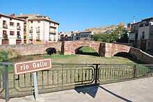
- Roman bridge (Puente Viejo)
- Convent of St. Francis
- Giraldo (St. Francis Church Bell Tower)
- Church of Santa Clara
- Church of Santa María de San Gil

Old bridge over the Gallo river, 13th century, in the background the Medieval alcazar of Molina de Aragón, Spain.

Giraldo on top of St. Francis Church bell Tower.

A typical inn (built 1826) at Molina de Aragón, Spain.
| Wikimedia Commons has media related to Molina de Aragón. |
Notes
- ↑ Extreme temperatures in Spain
- ↑ Simon Barton, The Aristocracy in Twelfth-century León and Castile (Cambridge: Cambridge University Press, 1997), 265.
This article is issued from Wikipedia. The text is available under the Creative Commons Attribution/Share Alike; additional terms may apply for the media files.

