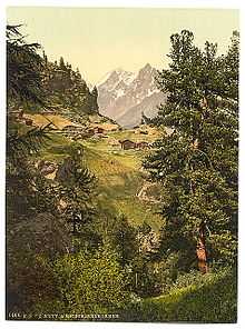
Mischabelhörner
From Wikipedia, the free encyclopedia
| Mischabelhörner | |
|---|---|
| Mischabel | |
 From left to right the Dom, Täschhorn, and Alphubel | |
| Highest point | |
| Peak | Dom |
| Elevation | 4,545 m (14,911 ft) |
| Coordinates | 46°05′42″N 7°51′36″E / 46.09500°N 7.86000°E |
| Geography | |
<div style="padding:2px 2px 5px 2px;> | |
| Country | Switzerland |
| Canton | Valais |
| Range coordinates | 46°05′N 7°53′E / 46.08°N 7.88°ECoordinates: 46°05′N 7°53′E / 46.08°N 7.88°E |

The Mischabel range seen from Kreuzboden Lake.
The Mischabelhörner, or just Mischabel, is a massif in the Pennine Alps of Valais, Switzerland, which forms the divide between the Saastal and Mattertal. Of all its summits, the highest is the Dom; at 4545 m the highest peak completely inside Switzerland. The other two chief summits are the Täschhorn (4491 m), and Südlenz or Lenzspitze (4294 m).

Zmutt Valley with Mischabelhörner group, Valais, Alps of, Switzerland - 1890 photochrom postcard
This article is issued from Wikipedia. The text is available under the Creative Commons Attribution/Share Alike; additional terms may apply for the media files.