Mingə
From Wikipedia, the free encyclopedia
Coordinates: 40°42′31″N 48°19′36″E / 40.70861°N 48.32667°E
| Mingə | |
|---|---|
 Mingə | |
| Coordinates: 40°42′31″N 48°19′36″E / 40.70861°N 48.32667°E | |
| Country |
|
| Rayon | Ismailli |
| Municipality | Keyvəndi |
| Time zone | AZT (UTC+4) |
| • Summer (DST) | AZT (UTC+5) |
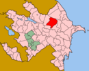
Mingə is a village in the Ismailli Rayon of Azerbaijan. The village forms part of the municipality of Keyvəndi.[1] The area is renowned for excessive bush and dryness, due to being situated on one of the two highest peaks of Azerbaijan.
References
This article is issued from Wikipedia. The text is available under the Creative Commons Attribution/Share Alike; additional terms may apply for the media files.
