Minbya
From Wikipedia, the free encyclopedia
| Minbya မင်းပြား | |
|---|---|
 | |
 Minbya | |
| Coordinates: 20°09′00″N 92°54′00″E / 20.15000°N 92.90000°E | |
| Country |
|
| Division | Rakhine State |
| District | Sittwe District |
| Township | Minbya Township |
| Population (2006) | |
| • Total | 181,000 |
| • Ethnicities | Rakhine |
| • Religions | Buddhism |
| Time zone | MST (UTC+6.30) |
| Area code(s) | 42, 43 |
| [1] | |
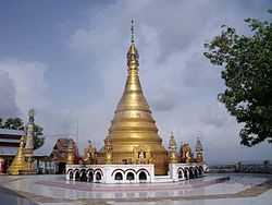
Minbya (Burmese: မင်းပြားမြို့, pronounced: [mɪ́ɴbjá mjo̰]) is a town in the Rakhine State of westernmost part of Myanmar.
Education
BEHS Minbya is the sole high school in the town.
Natural disasters
On 15 June 2010, strong rains destroyed more than 25 buildings, including houses, school buildings, and a mosque. Close to 200 people were housed in mosques of several nearby villages.[2]
On 12 November 2011, all 567 permanent shops of the Minbya central market were destroyed in a fire accident.[3]


External links
References
- ↑ "National Telephone Area Codes". Myanmar Yellow Pages.
- ↑ Myanmar: Downpours, strong winds cause death, injury, damage to houses, roads, railroad sections, floods, landslides State, departments, Tatmadawmen, NGOs and wellwishers render assistance for relief and rehabilitation
- ↑ http://www.mrtv3.net.mm/newpaper/1511newsn.pdf Page 6 Col 1
| |||||||||||||||||||||||


Coordinates: 20°22′N 93°16′E / 20.367°N 93.267°E
This article is issued from Wikipedia. The text is available under the Creative Commons Attribution/Share Alike; additional terms may apply for the media files.