Mengkofen
From Wikipedia, the free encyclopedia
| Mengkofen | ||
|---|---|---|
_Mengkofen.JPG) | ||
| ||
 Mengkofen | ||
Location of Mengkofen within Dingolfing-Landau district 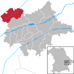 | ||
| Coordinates: 48°43′N 12°26′E / 48.717°N 12.433°ECoordinates: 48°43′N 12°26′E / 48.717°N 12.433°E | ||
| Country | Germany | |
| State | Bavaria | |
| Admin. region | Niederbayern | |
| District | Dingolfing-Landau | |
| Subdivisions | 10 Ortschaften | |
| Government | ||
| • Mayor | Karl Maier | |
| Area | ||
| • Total | 86.00 km2 (33.20 sq mi) | |
| Elevation | 398 m (1,306 ft) | |
| Population (2012-12-31)[1] | ||
| • Total | 5,845 | |
| • Density | 68/km2 (180/sq mi) | |
| Time zone | CET/CEST (UTC+1/+2) | |
| Postal codes | 84152 | |
| Dialling codes | 08733, 08774, 09427 | |
| Vehicle registration | DGF | |
| Website | Official website | |

Mengkofen is a municipality in the district of Dingolfing-Landau in Bavaria in Germany.
Subdivision
The municipality includes 10 former municipalities (Gemarkungen), and other villages:[2]
- Hofdorf
- Hüttenkofen
- Martinsbuch
- Mengkofen
- Mühlhausen
- Puchhausen
- Süßkofen
- Ginhart
- Hagenau
- Tunding
- Tunzenberg
- Weichshofen
References
- ↑ "Fortschreibung des Bevölkerungsstandes". Bayerisches Landesamt für Statistik und Datenverarbeitung (in German). 31 December 2012.
- ↑ (German) Infos at municipal website
External links
![]() Media related to Mengkofen at Wikimedia Commons
Media related to Mengkofen at Wikimedia Commons
| |||||||
This article is issued from Wikipedia. The text is available under the Creative Commons Attribution/Share Alike; additional terms may apply for the media files.