Meloisey
From Wikipedia, the free encyclopedia
| Meloisey | ||
|---|---|---|
 | ||
| ||
 Meloisey | ||
|
Location within Burgundy region  Meloisey | ||
| Coordinates: 47°02′02″N 4°44′09″E / 47.0339°N 4.7358°ECoordinates: 47°02′02″N 4°44′09″E / 47.0339°N 4.7358°E | ||
| Country | France | |
| Region | Burgundy | |
| Department | Côte-d'Or | |
| Arrondissement | Beaune | |
| Canton | Beaune-Nord | |
| Intercommunality | Beaune Côte et Sud | |
| Government | ||
| • Mayor (2008–2014) | Jean-Paul Gueret | |
| Area | ||
| • Land1 | 12.27 km2 (4.74 sq mi) | |
| Population (2008) | ||
| • Population2 | 285 | |
| • Population2 Density | 23/km2 (60/sq mi) | |
| INSEE/Postal code | 21401 / 21190 | |
| Elevation | 281–590 m (922–1,936 ft) | |
|
1 French Land Register data, which excludes lakes, ponds, glaciers > 1 km² (0.386 sq mi or 247 acres) and river estuaries. 2 Population without double counting: residents of multiple communes (e.g., students and military personnel) only counted once. | ||
.svg.png)
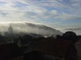
Meloisey is a commune in the Côte-d'Or department in eastern France.
Meloisey is a village of the Hautes Côtes de Beaune wine region, close to Beaune.
Population
| Historical population | ||
|---|---|---|
| Year | Pop. | ±% |
| 1836 | 592 | — |
| 1841 | 570 | −3.7% |
| 1846 | 591 | +3.7% |
| 1851 | 647 | +9.5% |
| 1856 | 607 | −6.2% |
| 1861 | 627 | +3.3% |
| 1866 | 628 | +0.2% |
| 1872 | 634 | +1.0% |
| 1876 | 701 | +10.6% |
| 1886 | 712 | +1.6% |
| 1896 | 624 | −12.4% |
| 1906 | 578 | −7.4% |
| 1911 | 530 | −8.3% |
| 1921 | 418 | −21.1% |
| 1926 | 357 | −14.6% |
| 1931 | 334 | −6.4% |
| 1962 | 293 | −12.3% |
| 1968 | 295 | +0.7% |
| 1975 | 271 | −8.1% |
| 1982 | 291 | +7.4% |
| 1990 | 318 | +9.3% |
| 1999 | 303 | −4.7% |
| 2008 | 285 | −5.9% |
See also
References
External links
| Wikimedia Commons has media related to Meloisey. |
This article is issued from Wikipedia. The text is available under the Creative Commons Attribution/Share Alike; additional terms may apply for the media files.