Marshall Pass

Marshall Pass, elevation 10,842 ft (3,305 m), is a mountain pass in the Rocky Mountains of central-southern Colorado. It lies in northern Saguache County on the Continental Divide between the Sawatch Range to the north and the Cochetopa Hills to the south. The pass is part of a backcountry alternative to U.S. Highway 50 between Salida and Gunnison.
Marshall Pass was discovered by and named for Lt. William L. Marshall, of the Wheeler Survey, in 1873.[1]
History
Marshall Pass was part of the narrow gauge Denver and Rio Grande Western Railroad transcontinental route from Denver to Salt Lake City. The railroad line was completed in 1881, ahead of the Alpine Tunnel by the Denver, South Park and Pacific Railroad. The line saw the daily Shavano passenger train until closure. The line closed with the Gunnison Division in 1955, and the rails were removed the same year.
Marshall Pass, Colorado was a small settlement, railroad station and post office, located at the pass. The population was 11 in 1948; there were six buildings then. Time Magazine called it "the U.S.'s smallest post office." [2]
Geography
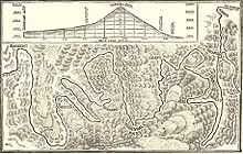
Marshall Pass is just a few miles south of Monarch Pass, and in fact both were considered as potential routes for U.S. 50, with the latter ultimately being chosen. Today, a gravel road still follows the old railroad route over Marshall Pass. In the summer and late fall, this drive is especially beautiful. It may be driven by regular passenger cars in good conditions.
From the east, take U.S. 285 south from Poncha Springs (near Salida) about 6 miles to County Road 200 and turn right; from the west turn right off U.S. 50 at Sargents. While grades are gentler (the railroad had a ruling grade of 4%) than on U.S. 50 over Monarch Pass (7% grades), please note that the Marshall Pass Road is closed to wheeled vehicles during the winter months. Marshall Pass is usually—but not always—a better route for small aircraft passing over the Continental Divide than is Monarch Pass.
Gallery
-

A great deal of Philatelic mail originated at the post office at Marshall Pass
-

Denver & Rio Grande Railroad train at Marshall Pass, around 1890. Photo by William Henry Jackson.
References
| Wikimedia Commons has media related to Marshall Pass. |
External links
Coordinates: 38°23′29″N 106°14′50″W / 38.39139°N 106.24722°W