Margaret Island

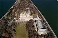
Margaret Island (Hungarian: Margit-sziget, German: Margaretheninsel) is a 2.5 km (1.6 mi) long island, 500 metres (550 yards) wide, (0.965 km2 (238 acres) in area) in the middle of the Danube in central Budapest, Hungary. It belongs administratively to the 13th district under the name of Margitsziget. The island is mostly covered by landscape parks, and is a popular recreational area. Its medieval ruins are reminders of its importance in the Middle Ages as a religious centre. The island spans the area between the Margaret Bridge (south) and the Árpád Bridge (north).
Today's appearance was developed through the connection of three separate islands, the Festő, the Fürdő and the Nyulak, during the end of the 19th century, to control the flow of the Danube. Originally, the island was 102.5 metres above sea level, but now has been built up to 104.85 metres above sea level to control flooding[1]
Name
The island was called Ujvalvijifche[2] (possibly from Uj-water and val-waves) in the Middle Ages, and it received its current name after Saint Margaret (1242–1270), the daughter of Béla IV of Hungary who lived in the Dominican convent on the island.[3] Other names of the island were Nagyboldogasszony-sziget, Úr-sziget, Budai-sziget, Dunai-sziget, Nádor-sziget, Palatinus-sziget during different periods of its history. (The names mean Island of Our Lady, Island of Nobles, Buda Island, Danube Island, Palatine Island.)
History
The Knights of St. John settled on the island in the 12th century. Among the present historical monuments of the island are the 13th century ruins of a Franciscan church and a Dominican church and convent, as well as a Premonstratensian church from the 12th century. Members of the Augustinian order also lived on the island.
The island was dominated by nunneries, churches and cloisters until the 16th century. During the Ottoman wars the monks and nuns fled and the buildings were destroyed. In the 18th century it was chosen to be the resort of palatines. It was declared a public garden in 1908.

Since the 1980s, entry by cars has been limited; only a single bus line and taxis, alongside the service traffic of local stores and restaurants are allowed to enter. On the northern end of the island a car park houses the cars of hotel guests.
There is a 5350 metre long, rubber-coated jogging track around the island, marked at 500 metre intervals.
Landmarks
- the Centennial Memorial of 1973, commemorating the hundredth anniversary of the city's unification;
- a small Japanese Garden with a mildly thermal fish pond;
- a tiny zoo featuring a wide range of exotic waterfowl among other animals;
- the "Music Well" (Zenélő kút), a small pavilion, which was originally built for open-air concerts (it is close to Árpád bridge);
- the "Music Fountain" (Zenélő szökőkút), a fountain near which music is played and light shows are performed in summer (it is close to Margaret bridge). The water springs out according to music, so that the fountain seems to dance at the various classical themes reproduced. The last piece played is Con te partirò sung by Andrea Bocelli;
- an octagonal Water Tower of 57 m (built in Art Nouveau style in 1911, today functioning as a lookout tower and an exhibition hall, see picture).
The Music Fountain and the Water Tower are protected UNESCO sites.
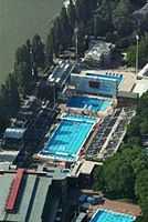
The island houses various sports establishments, like the Palatinus water park (the largest open-air swimming complex in Budapest), the Alfréd Hajós sports pool (where the European LC Championships 1958, 2006 and 2010 took place), a tennis stadium and an athletics centre.
Two hotels provide accommodation: the fin de siècle Grand Hotel Margitsziget, and the modern Thermal Hotel Margitsziget with thermal spa and various medical services. There is also an open-air theatre accommodating an audience of 3500, and several clubs and restaurants. For exploration and pastime, four-person cycle cars or small electric cars can be rented for use on the area of the island.
Gallery
-

Margaret Island in 1888: the bridge was not connected to the island; future Újlipótváros streets shown on map
-

Margaret Island in 1905: the bridge is already connected to the island and Újlipótváros developed
-

Margaret Island today (top of picture)
-

Margaret Island today (airplane view - engine)
-

The water tower and the open-air theater
-

Hotels at the northern end
-

Hajós Alfréd Sports Pool
-

The sports pool and the trees of the island
-

Ruins of the old church
References
- ↑ http://www.aviewoncities.com/budapest/margaretisland.htm
- ↑ https://play.google.com/books/reader?printsec=frontcover&output=reader&id=sFNGAAAAYAAJ&pg=GBS.PT55
- ↑ "Margaret's Isle, Budapest, Hungary, Austro-Hungary". World Digital Library. Retrieved 19 January 2013.
External links
| Wikimedia Commons has media related to Margaret Island. |
Coordinates: 47°32′N 19°03′E / 47.533°N 19.050°E
