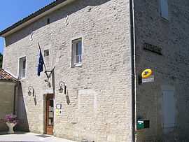
Mareuil, Charente
From Wikipedia, the free encyclopedia
| Mareuil | |
|---|---|
 | |
 Mareuil | |
|
Location within Poitou-Charentes region  Mareuil | |
| Coordinates: 45°46′28″N 0°08′24″W / 45.7744°N 0.14°WCoordinates: 45°46′28″N 0°08′24″W / 45.7744°N 0.14°W | |
| Country | France |
| Region | Poitou-Charentes |
| Department | Charente |
| Arrondissement | Cognac |
| Canton | Rouillac |
| Intercommunality | Rouillacais |
| Government | |
| • Mayor (2008–2014) | Claudine Rodet |
| Area | |
| • Land1 | 11.51 km2 (4.44 sq mi) |
| Population (2008) | |
| • Population2 | 385 |
| • Population2 Density | 33/km2 (87/sq mi) |
| INSEE/Postal code | 16208 / 16170 |
| Elevation |
53–125 m (174–410 ft) (avg. 164 m or 538 ft) |
|
1 French Land Register data, which excludes lakes, ponds, glaciers > 1 km² (0.386 sq mi or 247 acres) and river estuaries. 2 Population without double counting: residents of multiple communes (e.g., students and military personnel) only counted once. | |
Mareuil is a commune in the Charente department in southwestern France.
Population
| Historical population | ||
|---|---|---|
| Year | Pop. | ±% |
| 1793 | 696 | — |
| 1800 | 722 | +3.7% |
| 1806 | 790 | +9.4% |
| 1821 | 769 | −2.7% |
| 1831 | 782 | +1.7% |
| 1841 | 764 | −2.3% |
| 1846 | 767 | +0.4% |
| 1851 | 768 | +0.1% |
| 1856 | 781 | +1.7% |
| 1861 | 840 | +7.6% |
| 1866 | 842 | +0.2% |
| 1872 | 824 | −2.1% |
| 1876 | 779 | −5.5% |
| 1881 | 643 | −17.5% |
| 1886 | 605 | −5.9% |
| 1891 | 558 | −7.8% |
| 1896 | 541 | −3.0% |
| 1901 | 512 | −5.4% |
| 1906 | 522 | +2.0% |
| 1911 | 524 | +0.4% |
| 1921 | 445 | −15.1% |
| 1926 | 451 | +1.3% |
| 1931 | 433 | −4.0% |
| 1936 | 417 | −3.7% |
| 1946 | 379 | −9.1% |
| 1954 | 357 | −5.8% |
| 1962 | 342 | −4.2% |
| 1968 | 319 | −6.7% |
| 1975 | 333 | +4.4% |
| 1982 | 298 | −10.5% |
| 1990 | 360 | +20.8% |
| 1999 | 351 | −2.5% |
| 2008 | 385 | +9.7% |
See also
References
| Wikimedia Commons has media related to Mareuil (Charente). |
This article is issued from Wikipedia. The text is available under the Creative Commons Attribution/Share Alike; additional terms may apply for the media files.