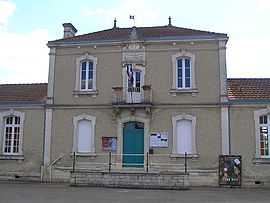
Marcillac-Lanville
From Wikipedia, the free encyclopedia
| Marcillac-Lanville | |
|---|---|
 | |
 Marcillac-Lanville | |
|
Location within Poitou-Charentes region  Marcillac-Lanville | |
| Coordinates: 45°50′50″N 0°01′15″E / 45.8472°N 0.0208°ECoordinates: 45°50′50″N 0°01′15″E / 45.8472°N 0.0208°E | |
| Country | France |
| Region | Poitou-Charentes |
| Department | Charente |
| Arrondissement | Cognac |
| Canton | Rouillac |
| Intercommunality | Rouillacais |
| Government | |
| • Mayor (2008–2014) | Yves Jean |
| Area | |
| • Land1 | 18.41 km2 (7.11 sq mi) |
| Population (2008) | |
| • Population2 | 597 |
| • Population2 Density | 32/km2 (84/sq mi) |
| INSEE/Postal code | 16207 / 16140 |
| Elevation |
47–136 m (154–446 ft) (avg. 108 m or 354 ft) |
|
1 French Land Register data, which excludes lakes, ponds, glaciers > 1 km² (0.386 sq mi or 247 acres) and river estuaries. 2 Population without double counting: residents of multiple communes (e.g., students and military personnel) only counted once. | |
Marcillac-Lanville is a commune in the Charente department in southwestern France.
Population
| Historical population | ||
|---|---|---|
| Year | Pop. | ±% |
| 1793 | 1,244 | — |
| 1800 | 1,311 | +5.4% |
| 1806 | 1,402 | +6.9% |
| 1821 | 1,445 | +3.1% |
| 1831 | 1,518 | +5.1% |
| 1841 | 1,507 | −0.7% |
| 1846 | 1,516 | +0.6% |
| 1851 | 1,437 | −5.2% |
| 1856 | 1,402 | −2.4% |
| 1861 | 1,527 | +8.9% |
| 1866 | 1,450 | −5.0% |
| 1872 | 1,405 | −3.1% |
| 1876 | 1,435 | +2.1% |
| 1881 | 1,271 | −11.4% |
| 1886 | 1,137 | −10.5% |
| 1891 | 1,049 | −7.7% |
| 1896 | 1,039 | −1.0% |
| 1901 | 1,014 | −2.4% |
| 1906 | 991 | −2.3% |
| 1911 | 890 | −10.2% |
| 1921 | 785 | −11.8% |
| 1926 | 714 | −9.0% |
| 1931 | 728 | +2.0% |
| 1936 | 745 | +2.3% |
| 1946 | 675 | −9.4% |
| 1954 | 678 | +0.4% |
| 1962 | 640 | −5.6% |
| 1968 | 564 | −11.9% |
| 1975 | 576 | +2.1% |
| 1982 | 551 | −4.3% |
| 1990 | 534 | −3.1% |
| 1999 | 565 | +5.8% |
| 2008 | 597 | +5.7% |
See also
References
| Wikimedia Commons has media related to Marcillac-Lanville. |
This article is issued from Wikipedia. The text is available under the Creative Commons Attribution/Share Alike; additional terms may apply for the media files.