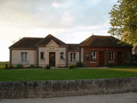
Marchezais
From Wikipedia, the free encyclopedia
| Marchezais | ||
|---|---|---|
 | ||
| ||
 Marchezais | ||
|
Location within Centre region  Marchezais | ||
| Coordinates: 48°46′23″N 1°30′32″E / 48.7731°N 1.5089°ECoordinates: 48°46′23″N 1°30′32″E / 48.7731°N 1.5089°E | ||
| Country | France | |
| Region | Centre | |
| Department | Eure-et-Loir | |
| Arrondissement | Dreux | |
| Canton | Anet | |
| Intercommunality | Villages du Drouais | |
| Government | ||
| • Mayor (2008–2014) | Bernard Letellier | |
| Area | ||
| • Land1 | 2.19 km2 (0.85 sq mi) | |
| Population (2008) | ||
| • Population2 | 289 | |
| • Population2 Density | 130/km2 (340/sq mi) | |
| INSEE/Postal code | 28235 / 28410 | |
| Elevation |
132–139 m (433–456 ft) (avg. 138 m or 453 ft) | |
|
1 French Land Register data, which excludes lakes, ponds, glaciers > 1 km² (0.386 sq mi or 247 acres) and river estuaries. 2 Population without double counting: residents of multiple communes (e.g., students and military personnel) only counted once. | ||
.svg.png)
Marchezais is a commune in the Eure-et-Loir department in northern France.
Population
| Historical population | ||
|---|---|---|
| Year | Pop. | ±% |
| 1962 | 43 | — |
| 1968 | 47 | +9.3% |
| 1975 | 99 | +110.6% |
| 1982 | 169 | +70.7% |
| 1990 | 221 | +30.8% |
| 1999 | 208 | −5.9% |
| 2008 | 289 | +38.9% |
See also
References
| Wikimedia Commons has media related to Marchezais. |
This article is issued from Wikipedia. The text is available under the Creative Commons Attribution/Share Alike; additional terms may apply for the media files.