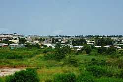
Manzini District
From Wikipedia, the free encyclopedia
| Manzini District | |
|---|---|
 | |
 | |
| Coordinates: 26°15′S 31°30′E / 26.250°S 31.500°E | |
| Country | Swaziland |
| Capital | Manzini |
| Area | |
| • Total | 4,093.59 km2 (1,580.54 sq mi) |
| Population (2007 census) | |
| • Total | 319,530 |
| • Density | 78/km2 (200/sq mi) |
Manzini is a district of Swaziland, located in the center-west of the country. It has an area of 4,093.59 km² and a population of 319,530 (2007),[1] and is divided into 16 tinkhundla. Its administrative center is Manzini. It borders all three other districts: Hhohho in the north, Lubombo in the east, and Shiselweni in the south. It is bordered by the Mpumalanga province in South Africa to the west.
References
| ||||||||||||||
| |||||||||||||||||||||||||||||||||
Coordinates: 26°15′S 31°30′E / 26.250°S 31.500°E
This article is issued from Wikipedia. The text is available under the Creative Commons Attribution/Share Alike; additional terms may apply for the media files.