Malpighi Glacier
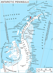
Malpighi Glacier (64°16′S 62°15′W / 64.267°S 62.250°WCoordinates: 64°16′S 62°15′W / 64.267°S 62.250°W) is a glacier 5 nautical miles (9 km) long and 1 nautical mile (2 km) wide, flowing southeast from the Harvey Heights to join Mackenzie Glacier at the east coast of Brabant Island, in the Palmer Archipelago, Antarctica. It was first roughly charted by the Belgian Antarctic Expedition, 1897–99, under Gerlache. The glacier was photographed by Hunting Aerosurveys Ltd in 1956–57, and mapped from these photos in 1959. It was named by the UK Antarctic Place-Names Committee for Marcello Malpighi, an Italian physiologist and pioneer histologist who first demonstrated the existence of the blood capillaries.[1]
References
- ↑ "Malpighi Glacier". Geographic Names Information System, U.S. Geological Survey. Retrieved 2013-07-30.
![]() This article incorporates public domain material from the United States Geological Survey document "Malpighi Glacier" (content from the Geographic Names Information System).
This article incorporates public domain material from the United States Geological Survey document "Malpighi Glacier" (content from the Geographic Names Information System).