Majdelyoun
| Majdelyoun مجدليون | ||
|---|---|---|
| Town | ||
| ||
 Majdelyoun | ||
| Coordinates: 33°33′39″N 35°24′38″E / 33.56083°N 35.41056°ECoordinates: 33°33′39″N 35°24′38″E / 33.56083°N 35.41056°E | ||
| Country |
| |
| Governorate | South Governorate | |
| District | Southern District | |
| Government | ||
| • Type | Mayor-council | |
| • Body | Majdelyoun municipality | |
| Area | ||
| • Total | 1.5 km2 (0.6 sq mi) | |
| Highest elevation | 210 m (690 ft) | |
| Time zone | EET (UTC+2) | |
| • Summer (DST) | +3 (UTC) | |
| Area code(s) | 7 | |
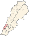
Majdelyoun (Arabic: مجدليون) is a town in southern Lebanon. It is located 45 kilometers (28 miles) away from Beirut, the capital of Lebanon, and 5 km east of Sidon at an elevation of 210 meters (689 feet) above sea level. Majdelyoun stretches for 150 hectares (1.5 km² - 0.579 mi²). The village is bordered with a number of villages/towns: East: Salhieh and Kfarjarra West: Haret Saida; North: Salhieh and Abra; and South: Ayn El Delb and Kfarjarra.
(Not to be confused with Majdelyoun town in Bekaa valley east of Beirut).
source 1 = Localiban,[1] source 2 = SaidaGate,[2]
Etymology
The origin of its name may return to Syriac word meaning: "guard tower" and "the castle", which shows originality in history, and that it was inhabited since ancient times, and its name could mean "small tower". Another explanation of the origin of its name is told by an old man called Tanios Fakhoury who said that the name of the town is related to a person named Leon, and has had a great glory (majd مجد in Arabic) days with the French and earlier, and probably lived in the town which led to Majdelyoun’s name (Majd - Lyon)
source 3 = SaidaGate,[2]
Organization
.JPG)
Majdelyoun is famous for its palaces (among them Rafik Hariri’s palace) and villas that are integrated with the green nature to make a distinctive town. It is well organized as it is divided by three parallel streets. Approximately half the area of the town is still green.
The town has been divided into two regions:
- Lower region for residential buildings
- higher region for luxury villas.
.JPG)
.JPG)
Demographics
Majdelyoun is a model of coexistence, with a population of Muslims and Christians. The number of residents registered in accordance with the electoral restrictions amounts to about 3500 people (1,500 people lives in the town). Registered residents are divided as following: 4% Muslims (Sunni and Shiaa) and 96% Christians (Catholic, Maronite, Orthodox … etc.). The total number of actual residents is more than 10000 people.
source 4 = SaidaGate,[2]
Economy & Education
Majdelyoun was famous in ancient times for olive cultivation, but the circumstances have changed in the past years and confined its business today on some shops which began to grow steadily, especially on the highway, and contribute to the revitalization of the economical movement. The town is lacking public and private establishments as there are no schools or hospitals, and it has only one Catholic church and two mosques.
source 5 = SaidaGate,[3] source 6 = ebaladiyat,[4]
Panoramic View

Landscape
.JPG)
.JPG)
.JPG)
.JPG)
.JPG)
Weather
August is warmest with an average temperature of 31.1 °C at noon. January is coldest with an average temperature of 9.3 °C at night. Majdelyoun has temperate cold and warm seasons, like winters and summers. The temperatures do not differ much between day and night.
Winter can have some frost days, with the coldest month most often being January. September is on average the month with most sunshine. Rainfall and other precipitation peaks around December. The time around June is driest.
source 7 = Chinci.com,[3]
| Climate data for Majdelyoun, Lebanon | |||||||||||||
|---|---|---|---|---|---|---|---|---|---|---|---|---|---|
| Month | Jan | Feb | Mar | Apr | May | Jun | Jul | Aug | Sep | Oct | Nov | Dec | Year |
| Average high °C (°F) | 17 (62.6) |
18 (64.4) |
20 (68) |
23 (73.4) |
26 (78.8) |
28 (82.4) |
30 (86) |
31 (87.8) |
30 (86) |
28 (82.4) |
23 (73.4) |
19 (66.2) |
24.4 (75.95) |
| Average low °C (°F) | 11 (51.8) |
11 (51.8) |
13 (55.4) |
15 (59) |
18 (64.4) |
22 (71.6) |
24 (75.2) |
25 (77) |
24 (75.2) |
21 (69.8) |
16 (60.8) |
13 (55.4) |
17.8 (63.95) |
| Precipitation mm (inches) | 132.6 (5.22) |
114 (4.5) |
61.5 (2.42) |
24.9 (.98) |
12.7 (.50) |
1 (.04) |
0 (0) |
3 (.12) |
5 (.2) |
47 (1.85) |
94.2 (3.71) |
128 (5.04) |
624.3 (24.58) |
| Avg. precipitation days (≥ 0.25 mm) | 14 | 11 | 10 | 6 | 3 | 0 | 0 | 0 | 2 | 6 | 9 | 13 | 74 |
| [citation needed] | |||||||||||||
Geographic Location
 |
Abra | Salhieh |  | |
| Sidon, Haret Saida | |
Salhieh,kfarjarra | ||
| ||||
| | ||||
| Ayn El Delb |
References
- ↑ "LocaLiban". Retrieved 2007-06-26.
- ↑ 2.0 2.1 2.2 "SaidaGate". Retrieved 2007-08-30.
- ↑ 3.0 3.1 "SaidaGate". Retrieved 2013-09-27.
- ↑ "ebaladiyat". Retrieved 2013-09-27.
| ||||||||||

.JPG)
