Macmerry
| Macmerry | |
 Macmerry | |
| Population | 1,113 |
|---|---|
| OS grid reference | NT435723 |
| Council area | East Lothian |
| Lieutenancy area | East Lothian |
| Country | Scotland |
| Sovereign state | United Kingdom |
| Post town | TRANENT |
| Postcode district | EH33 |
| Dialling code | 01875 |
| Police | Scottish |
| Fire | Scottish |
| Ambulance | Scottish |
| EU Parliament | Scotland |
| UK Parliament | East Lothian |
| Scottish Parliament | East Lothian |
Macmerry (Gaelic: Magh Mhoire) is a large village located on the old A1 (now renumbered the A199) just east of Tranent.
The village has a primary school with a roll of around 100.
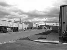
There is an industrial estate to the east of the town. Originally this area was part of the Macmerry Aerodrome, also known as Penston, which closed in 1953.
There was a railway branch line until 1980 which served the local coalmines.
In 2009 a community based history project was launched by the Living Memory Association. The Macmerry Lives project collected memories of the school, pottery making, the aerodrome, mining industry and local farming.
Macmerry now boasts a range of facilities that have grown as the village has grown, some of these include:
- Macmerry Miners Welfare Club
- Large football field
- 3 Kids play parks including a large playpark for older and younger kids next to the football field
- Village shop
- Bowling Green
- 1 car garage
- Pizza Den, a local favourite take away
- School with a nursery
- Men's Shed
- R&R Butchers/Deli
Many teams from around East Lothian often play at Macmerry football pitches, while the bowling club is often busy especially on Friday nights for the league matches.