Mérida cable car


The Mérida Cable Car (Spanish: Teleférico de Mérida) is the cable car in Venezuela. Its base is located in the Venezuelan city of Mérida at an altitude of 1,640 metres (5,380 ft), and its terminus is on Pico Espejo, at 4,765 metres (15,633 ft). The whole system was opened to the public in 1960; it was closed indefinitely in 2008, with a declaration that it had reached the end of its service life and is being rebuilt.[1] The Mérida cable car is the highest and largest cable car in the world.
Structure
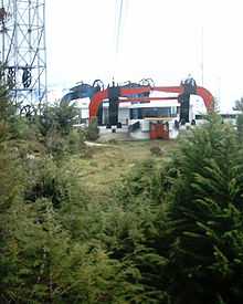
The Mérida Cable Car is constituted by four cable cars connected serially, making it easy to move across 12.5 kilometres (7.8 mi) and overcome the unevenness between the city of Mérida and the Espejo Peak.
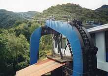
Each section of route has two lanes, in each lane there is a cable-car that has a capacity to transport 36 passengers. The cable-car moves with a velocity of 5 metres per second (18 km/h; 11 mph) thanks to the suspended cable that is actioned by an engine. There are two different engines: the first in the La Montaña station that serves to the section between that station and the La Aguada station. The other one is located in the Loma Redonda station and serves the rest of the sections.
History and administration
This technological achievement emerged from a project of the former Andean Venezuelan Club (Club Andino Venezolano) in 1952, and its purpose was to make it easier for tourists and Andeans to ascend to the Sierra Nevada de Mérida. The idea was approved by the national government. In 1955 were started the topographic studies that would allow the design of the project and its immediate construction. In December 1956 the route towards the mountains was first traced.
On November 8, 1957, the first car of the Loading System arrived to La Aguada, overcoming the natural barriers of the Andean forests. Even if the inauguration was initially set amidst the celebration of the 400th anniversary of the city, it was never made official because of the death of Pius XII. In the end, the system opened to the public in March 1960.
The cable car itself was built in France by 25 different companies, hired by the famous enterprise Applevage, a specialist in cable cars. Other foreign companies assumed specialized tasks: Eggeca was in charge of the civil works; Egecom in charge of the metal structures; Sucre-Barret was also responsible for important tasks. The first three sections of the Loading cable car were built by the German company Heckel and the last one by the Swiss company Habegger.
Director of the works was Maurice Comte from France. Also standing out because of their work were several professional veterans from Italy, like Giovanni Rizzi, and Switzerland, like Raymond Ruffieux. Most of the work was performed by workers from towns from Mérida. Technicians and engineers came from many foreign countries, including Poland, Yugoslavia, Colombia and Haiti. The international contribution was evident up until its closure in 2008 as operators on the route would often speak in French, rather than Spanish.
The cable car is owned by the Venezuelan State and is under responsibility of the Vice-Ministry of Tourism.
Closing
On August 11, 2008 the Venezuelan Ministry of Tourism made it known that there would be an indefinite closure of the cable car service to the general public. Ten days later Titina Azuaje, head of the Ministry of Tourism, issued a press release informing that the closing had been decided on the basis of a conclusive report made by The Doppelmayr Group, which recommended not to make further repairs to the existing aerial tramway system since it reached the end of its service life. The construction of a brand-new cable car is underway with a 2012 reopening planned.[1]
Sections
- Barinitas Station: Located 1,640 MSL in the city of Mérida.
- La Montaña Station: Located 2,436 MSL.
- La Aguada Station: Located 3,452 MSL.
- Loma Redonda Station: Located 4,045 MSL.
- Pico Espejo Station: Located 4,765 MSL at the Pico Espejo
See also
| Wikimedia Commons has media related to Mérida cable car. |
References
Coordinates: 8°31′45″N 71°03′49″W / 8.52917°N 71.06361°W