Luning, Nevada
From Wikipedia, the free encyclopedia
| Luning | |
|---|---|
| Unincorporated Town | |
 | |
 Luning | |
| Coordinates: 38°30′23″N 118°10′53″W / 38.50639°N 118.18139°WCoordinates: 38°30′23″N 118°10′53″W / 38.50639°N 118.18139°W | |
| Country | United States |
| State | Nevada |
| County | Mineral |
| Time zone | Pacific (PST) (UTC-8) |
| • Summer (DST) | PDT (UTC-7) |
| ZIP codes | 89420 |
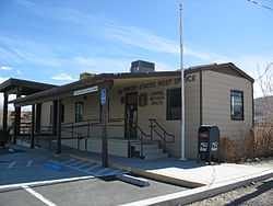
Luning is an Unincorporated Town in Mineral County, Nevada, in the United States. It is often listed as a ghost town, but it is not. The population of Luning, Nevada, as of 2005 is 87.[1] The town has a small store with attached gas station, volunteer fire department station, and a post office: the ZIP Code of Luning is 89420. There is also an active page for the "ghost" town on Facebook, maintained by residents.
Climate
The Köppen Climate System classifies the weather in this area as semi-arid, abbreviated BSk. This climate type occurs primarily on the periphery of true deserts in low-latitude semiarid steppe regions.[2]
| Climate data for Luning, Nevada | |||||||||||||
|---|---|---|---|---|---|---|---|---|---|---|---|---|---|
| Month | Jan | Feb | Mar | Apr | May | Jun | Jul | Aug | Sep | Oct | Nov | Dec | Year |
| Average high °C (°F) | 8 (47) |
12 (53) |
17 (62) |
20 (68) |
25 (77) |
30 (86) |
36 (96) |
34 (94) |
29 (85) |
22 (72) |
14 (57) |
9 (48) |
21.3 (70.4) |
| Average low °C (°F) | −4 (24) |
−2 (28) |
1 (33) |
3 (37) |
8 (46) |
12 (54) |
17 (62) |
16 (60) |
11 (52) |
6 (42) |
−1 (31) |
−4 (25) |
5.3 (41.2) |
| Precipitation mm (inches) | 10 (0.4) |
13 (0.5) |
10 (0.4) |
10 (0.4) |
18 (0.7) |
10 (0.4) |
8 (0.3) |
5 (0.2) |
5 (0.2) |
5 (0.2) |
10 (0.4) |
5 (0.2) |
109 (4.3) |
| Source: Weatherbase [3] | |||||||||||||
References
- ↑ "Nevada Power". Retrieved 2009-09-22.
- ↑ Climate Summary for Luning, Nevada
- ↑ "Weatherbase.com". Weatherbase. 2013. Retrieved on September 8, 2013.
| ||||||||||||||||||||

This article is issued from Wikipedia. The text is available under the Creative Commons Attribution/Share Alike; additional terms may apply for the media files.