Luang Namtha
| M. Nalae, Louang Namtha ມ. ນາແລ, ຫລວງນໍ້າທາ | |
|---|---|
| City | |
 | |
 M. Nalae, Louang Namtha | |
| Coordinates: 20°57′N 101°24′E / 20.950°N 101.400°E | |
| Country |
|
| Admin. division | Luang Namtha Province |
| Population (2004) | |
| • Total | 3,500 |
| • Religions | Buddhism |
| Time zone | UTC+07 |
Coordinates: 20°57′N 101°24′E / 20.950°N 101.400°E
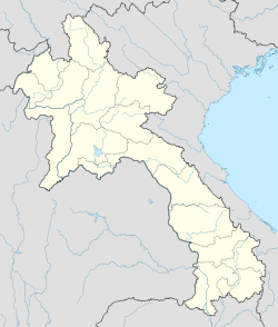
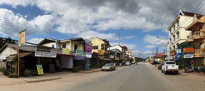
M. Nalae, Louang Namtha or M. Na Lae,Luang Nam Tha (Lao: ມ. ນາແລ, ຫລວງນໍ້າທາ) is the capital town of Luang Namtha Province in northern Laos. The city lies on the Tha River (Nam Tha).
Luang Namtha is the largest settlement in North-West of Laos, North of Luang Prabang. It is a popular tourist destination, and a base for treks, biking to the surrounding hill-tribe villages. It contains the Luang Namtha Museum.
Administrative divisions
The province comprises five districts:
- Long (3-03)
- Nalae (3-05)
- Namtha (3-01)
- Sing (3-02)
- Viangphoukha (3-04)
Transportation
In the rainy season, Luang Namtha can be reached by boat from the Mekong River. It is connected by Highway 3 to both the Thai border at Huay Xai/Chiang Khong (197 km (122 mi)) and the Chinese border at Boten/Mengla (60 km (37 mi)). Luang Namtha is also served by Luangnamtha Airport, 6 km (3.7 mi) south of the city.
Resorts
Gallery

-

Day market
-
Night market
-

Luang Namtha stupa
-

Harvesting rice
-

Riverside guesthouse
External links
-
 Luang Namtha travel guide from Wikivoyage
 - Ethnic diversity in Luang Namtha - Laos
- Facebook photo gallery
![]() Media related to Louang Namtha at Wikimedia Commons
Media related to Louang Namtha at Wikimedia Commons
