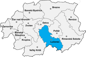
Lučenec District
| Lučenec District | |
|---|---|
| District | |
 | |
| Country | Slovakia |
| Region (kraj) | Banská Bystrica Region |
| Area | |
| • Total | 797 km2 (308 sq mi) |
| Population (2001) | |
| • Total | 72,837 |
| • Density | 91/km2 (240/sq mi) |
| Time zone | CET (UTC+1) |
| • Summer (DST) | CEST (UTC+2) |
| Telephone prefix | 47 |
Lučenec District (okres Lučenec) is a district in the Banská Bystrica Region of south-central Slovakia. Until 1918, most of the district belong to the Novohrad county, with a small area around the villages of Šíd, Čamovce and Šurice in the east belonging to the Gemer a Malohont county.
The district is situated in the Southern Slovak Basin, in the broad valley of the Ipeľ River. The two towns—Lučenec and Fiľakovo—comprise nearly 54% of the population of the district, the remainder living in the 55 surrounding villages.
The district lies on the E571 route (Route 50 in Slovak numbering) from Bratislava to Košice, and on one of the train lines connecting the two cities. Train services also run to Budapest via Fiľakovo. There is a small aerodrome at Boľkovce.
The main industries are food processing and building materials.
Municipalities
- Ábelová
- Belina
- Biskupice
- Boľkovce
- Budiná
- Bulhary
- Buzitka
- Čakanovce
- Čamovce
- Divín
- Dobroč
- Fiľakovo
- Fiľakovské Kováče
- Gregorova Vieska
- Halič
- Holiša
- Jelšovec
- Kalonda
- Kotmanová
- Lehôtka
- Lentvora
- Lipovany
- Lovinobaňa
- Ľuboreč
- Lučenec
- Lupoč
- Mašková
- Mikušovce
- Mučín
- Mýtna
- Nitra nad Ipľom
- Nové Hony
- Panické Dravce
- Píla
- Pinciná
- Pleš
- Podrečany
- Polichno
- Praha
- Prša
- Radzovce
- Rapovce
- Ratka
- Ružiná
- Šávoľ
- Šiatorská Bukovinka
- Šíd
- Stará Halič
- Šurice
- Točnica
- Tomášovce
- Trebeľovce
- Trenč
- Tuhár
- Veľká nad Ipľom
- Veľké Dravce
- Vidiná
Source
- Lučenec—ideal place for investment, published by Lučenec Town Council, Novohradská 1, 98401 Lučenec (Slovakia).
External links
| |||||||
Coordinates: 48°19′48″N 19°39′49″E / 48.33000°N 19.66361°E