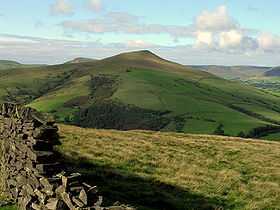
Lose Hill
| Lose Hill | |
|---|---|
 Lose Hill as seen from approach to Win Hill | |
| Elevation | 476 m (1,562 ft) |
| Prominence | 76 m (249 ft) |
| Location | |
| Location | Peak District, England |
| OS grid | SK153854 |
| Topo map | OS Landranger 110 |
Lose Hill lies in the Derbyshire Peak District. It is the south-east corner of the parish of Edale and the end of the Great Ridge that runs from Rushup Edge to the west (over Mam Tor, Hollins Cross and Back Tor).
Local access activist G. H. B. Ward was given an area of Lose Hill by the Sheffield and District Federation of the Ramblers Association in 1945, which was named Ward's Piece; he subsequently presented this to the National Trust.[1]

Its counterpart is Win Hill, lying to its east.
There is a legend of no great antiquity that Lose Hill gets its name from the Battle of Win Hill and Lose Hill in 626. Prince Cwichelm and his father, King Cynegils of Wessex, possibly with the aid of King Penda of Mercia, gathered their forces on Lose Hill and marched on the Northumbrians based on Win Hill. Despite their superior numbers, Wessex was defeated by the Northumbrians building a wall and rolling boulders down upon them. There is no record of this battle in any Anglo-Saxon source and it should best be regarded as a myth.
References
- ↑ "Local history", Dore to Door, Spring 2001
| ||||||||||||||
Coordinates: 53°21′55″N 1°46′18″W / 53.36525°N 1.77154°W
