Lonsee
From Wikipedia, the free encyclopedia
| Lonsee | ||
|---|---|---|
| ||
 Lonsee | ||
Location of Lonsee within Alb-Donau-Kreis district 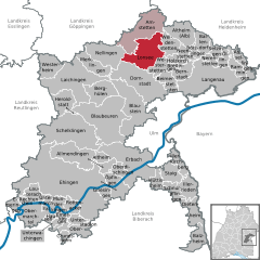
 | ||
| Coordinates: 48°32′36″N 9°55′17″E / 48.54333°N 9.92139°ECoordinates: 48°32′36″N 9°55′17″E / 48.54333°N 9.92139°E | ||
| Country | Germany | |
| State | Baden-Württemberg | |
| Admin. region | Tübingen | |
| District | Alb-Donau-Kreis | |
| Subdivisions | 7 | |
| Government | ||
| • Mayor | Jochen Ogger | |
| Area | ||
| • Total | 43.32 km2 (16.73 sq mi) | |
| Elevation | 564 m (1,850 ft) | |
| Population (2012-12-31)[1] | ||
| • Total | 4,760 | |
| • Density | 110/km2 (280/sq mi) | |
| Time zone | CET/CEST (UTC+1/+2) | |
| Postal codes | 89173 | |
| Dialling codes | 07336 | |
| Vehicle registration | UL | |
| Website | www.lonsee.de | |

Lonsee is a town in the Alb-Donau district in Baden-Württemberg in Germany. The population of Lonsee in 2008 is 4.758; the town consists of 7 villages - Ettlenschiess, Halzhausen, Sinabronn, Lonsee, Luizhausen and Urspring. The village has a town hall, a railway station (on the main line from Stuttgart to Munich) and two schools. Various clubs and groups provide for an active social life. Lonsee was first mentioned in the year 888, but the remains of a Roman fort in nearby Urspring tell of an even older history. Lonsee has been twinned with the English town of Kingskerswell since 1989.
References
- ↑ [Statistisches Bundesamt – Gemeinden in Deutschland mit Bevölkerung am 31.12.2012 (XLS-Datei; 4,0 MB) (Einwohnerzahlen auf Grundlage des Zensus 2011) "Gemeinden in Deutschland mit Bevölkerung am 31.12.2012"]. Statistisches Bundesamt (in German). 12 November 2013.
This article is issued from Wikipedia. The text is available under the Creative Commons Attribution/Share Alike; additional terms may apply for the media files.