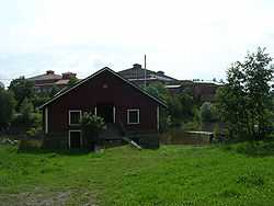
Loimaa
| Loimaa | ||
|---|---|---|
| Town | ||
| Loimaan kaupunki | ||
 | ||
| ||
 | ||
| Coordinates: 60°51′N 023°03.5′E / 60.850°N 23.0583°ECoordinates: 60°51′N 023°03.5′E / 60.850°N 23.0583°E | ||
| Country | Finland | |
| Region | Finland Proper | |
| Sub-region | Loimaa sub-region | |
| Market town | 1921 | |
| Town privileges | 1969 | |
| Government | ||
| • Town manager | Jari Rantala | |
| Area(2011-01-01)[1] | ||
| • Total | 851.93 km2 (328.93 sq mi) | |
| • Land | 847.97 km2 (327.40 sq mi) | |
| • Water | 3.96 km2 (1.53 sq mi) | |
| Area rank | 134th largest in Finland | |
| Population (2013-08-31)[2] | ||
| • Total | 16,840 | |
| • Rank | 69th largest in Finland | |
| • Density | 19.86/km2 (51.4/sq mi) | |
| Population by native language[3] | ||
| • Finnish | 98.6% (official) | |
| • Swedish | 0.2% | |
| • Others | 1.2% | |
| Population by age[4] | ||
| • 0 to 14 | 15.4% | |
| • 15 to 64 | 62.2% | |
| • 65 or older | 22.3% | |
| Time zone | EET (UTC+2) | |
| • Summer (DST) | EEST (UTC+3) | |
| Municipal tax rate[5] | 20.5% | |
| Website | www.loimaa.fi | |

Loimaa (Finnish pronunciation: [ˈloimɑː]) is a town and municipality of Finland.
It is located in the province of Western Finland and is part of the Finland Proper region. The municipality has a population of 16,840 (31 August 2013)[2] and covers an area of 851.93 square kilometres (328.93 sq mi) of which 3.96 km2 (1.53 sq mi) is water.[1] The population density is 19.86 inhabitants per square kilometre (51.4 /sq mi).
The town of Loimaa merged with Loimaan kunta (literally "Municipality of Loimaa") on January 1, 2005 and with Alastaro and Mellilä on January 1, 2009.
Subdivisions and Wards
Alastaron-Mäenpää, Eura, Haara, Haaroinen, Haitula, Hartoinen, Hattula, Hirvikoski, Hurskala, Ilmarinen, Inkilä, Joenperä, Juva, Karhula, Karsattila, Kauhanoja, Kemppilä, Kesärlä, Klockarla, Koenperä, Krekilä, Kuninkainen, Kurittula, Kuttila, Köyliö, Lappijoki, Levälä, Lähde, Metsämaa, Mäenpää, Niemi, Onkijoki, Pahikainen, Pappinen,[6] Peltoinen, Piltola, Puujalkala, Raikkola, Seppälä, Sieppala, Torkkala, Vesikoski, Vilvainen
Sights

- Alpo Jaakola Statue Park
- Heikintalo bison farm
- The church of Loimaa Proper
- Loimaa regional museum
- Mill of Krekilä
- Sarka, The Finnish Museum of Agriculture
- Mill of Vesikoski
International relations
Twin towns — Sister cities
Loimaa is twinned with:
-
 Åmål, Sweden
 -
 Uddevalla, Sweden
 -
 Frogn, Norway
 -
 Skien, Norway
 -
 Türi, Estonia
 -
 Jõhvi, Estonia
 -
 Staraya Russa, Russia
 -
 Mosfellsbær, Iceland
 -
 Thisted Municipality, Denmark
 -
 Grenå, Denmark
References
- ↑ 1.0 1.1 "Area by municipality as of 1 January 2011" (PDF) (in Finnish and Swedish). Land Survey of Finland. Retrieved 9 March 2011.
- ↑ 2.0 2.1 "VÄESTÖTIETOJÄRJESTELMÄ REKISTERITILANNE 31.8.2013" (in Finnish and Swedish). Population Register Center of Finland. Retrieved 15 September 2013.
- ↑ "Population according to language and the number of foreigners and land area km2 by area as of 31 December 2008". Statistics Finland's PX-Web databases. Statistics Finland. Retrieved 29 March 2009.
- ↑ "Population according to age and gender by area as of 31 December 2008". Statistics Finland's PX-Web databases. Statistics Finland. Retrieved 28 April 2009.
- ↑ "List of municipal and parish tax rates in 2011". Tax Administration of Finland. 29 November 2010. Retrieved 13 March 2011.
- ↑ Niinijoki – Pappinen (Finnish)
External links
![]() Media related to Loimaa at Wikimedia Commons
Media related to Loimaa at Wikimedia Commons
- Town of Loimaa – Official website
| ||||||||||||||

