Lichtenstein, Baden-Württemberg
From Wikipedia, the free encyclopedia
| Lichtenstein | ||
|---|---|---|
| ||
 Lichtenstein | ||
Location of Lichtenstein within Reutlingen district 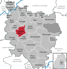
 | ||
| Coordinates: 48°25′37″N 09°15′13″E / 48.42694°N 9.25361°ECoordinates: 48°25′37″N 09°15′13″E / 48.42694°N 9.25361°E | ||
| Country | Germany | |
| State | Baden-Württemberg | |
| Admin. region | Tübingen | |
| District | Reutlingen | |
| Subdivisions | 4 Ortsteile | |
| Government | ||
| • Mayor | Peter Nußbaum | |
| Area | ||
| • Total | 34.24 km2 (13.22 sq mi) | |
| Elevation | 507 m (1,663 ft) | |
| Population (2012-12-31)[1] | ||
| • Total | 9,030 | |
| • Density | 260/km2 (680/sq mi) | |
| Time zone | CET/CEST (UTC+1/+2) | |
| Postal codes | 72805 | |
| Dialling codes | 07129 | |
| Vehicle registration | RT | |
| Website | www.gemeinde-lichtenstein.de | |

See Liechtenstein for the country.
Lichtenstein is a municipality in the Tübingen administrative region (Regierungsbezirk) in Baden-Württemberg, Germany. It lies at the foot of the Swabian Alb (plateau).
It was formed on January 1, 1975 from the former independent municipalities of Honau (Traifelberg), Holzelfingen, and Unterhausen.
Partner cities
Lichtenstein has been a partner city with:
Main sights
- Lichtenstein Castle is located above Honau.
- Johannes Church is in Unterhausen.
- Sankt-Blasius Church is in Holzelfingen.
References
- ↑ [Statistisches Bundesamt – Gemeinden in Deutschland mit Bevölkerung am 31.12.2012 (XLS-Datei; 4,0 MB) (Einwohnerzahlen auf Grundlage des Zensus 2011) "Gemeinden in Deutschland mit Bevölkerung am 31.12.2012"]. Statistisches Bundesamt (in German). 12 November 2013.
External links
![]() Media related to Lichtenstein (Württemberg) at Wikimedia Commons
Media related to Lichtenstein (Württemberg) at Wikimedia Commons
- Official website (German)
- Additional information (German)
| |||||||
This article is issued from Wikipedia. The text is available under the Creative Commons Attribution/Share Alike; additional terms may apply for the media files.