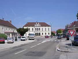
Levier
From Wikipedia, the free encyclopedia
| Levier | |
|---|---|
 | |
 Levier | |
|
Location within Franche-Comté region  Levier | |
| Coordinates: 46°57′15″N 6°07′10″E / 46.9542°N 6.1194°ECoordinates: 46°57′15″N 6°07′10″E / 46.9542°N 6.1194°E | |
| Country | France |
| Region | Franche-Comté |
| Department | Doubs |
| Arrondissement | Pontarlier |
| Canton | Levier |
| Intercommunality | Altitude 800 |
| Government | |
| • Mayor (2008–2014) | Albert Jeannin |
| Area | |
| • Land1 | 37.60 km2 (14.52 sq mi) |
| Population (2008) | |
| • Population2 | 1,934 |
| • Population2 Density | 51/km2 (130/sq mi) |
| INSEE/Postal code | 25334 / 25270 |
| Elevation | 679–901 m (2,228–2,956 ft) |
|
1 French Land Register data, which excludes lakes, ponds, glaciers > 1 km² (0.386 sq mi or 247 acres) and river estuaries. 2 Population without double counting: residents of multiple communes (e.g., students and military personnel) only counted once. | |
Levier is a French Commune in the Doubs department in the Franche-Comté region in eastern France.
Geography
Levier is located 20 km (12 mi) from Pontarlier, 45 km (28 mi) from Besançon, and 14 km (8.7 mi) from the TGV station at Frasne.
Population
| Historical population | ||
|---|---|---|
| Year | Pop. | ±% |
| 1962 | 1,332 | — |
| 1968 | 1,395 | +4.7% |
| 1975 | 1,446 | +3.7% |
| 1982 | 1,619 | +12.0% |
| 1990 | 1,785 | +10.3% |
| 1999 | 1,700 | −4.8% |
| 2005 | 1,881 | +10.6% |
| 2008 | 1,934 | +2.8% |
Economy
The economy is based on forestry.
See also
References
External links
| Wikimedia Commons has media related to Levier (Doubs). |
This article is issued from Wikipedia. The text is available under the Creative Commons Attribution/Share Alike; additional terms may apply for the media files.