Lenk im Simmental
| Lenk im Simmental | ||||||||||
|---|---|---|---|---|---|---|---|---|---|---|
 | ||||||||||
| Population | 2,463 (Dec 2012)[1] | |||||||||
| - Density | 20 /km2 (52 /sq mi) | |||||||||
| Area | 123.05 km2 (47.51 sq mi)[2] | |||||||||
| Elevation | 1,068 m (3,504 ft) | |||||||||
| Postal code | 3775 | |||||||||
| SFOS number | 0792 | |||||||||
| Surrounded by | Adelboden, Ayent (VS), Icogne (VS), Lauenen, Leukerbad (VS), Mollens (VS), Randogne (VS), Saanen, Sankt Stephan | |||||||||
| Website | www.lenkgemeinde.ch SFSO statistics | |||||||||
 Lenk im Simmental | ||||||||||
| Location of Lenk im Simmental
 | ||||||||||
Lenk im Simmental (or simply Lenk) is a municipality in the Obersimmental-Saanen administrative district in the canton of Bern in Switzerland.
History

Lenk is first mentioned in 1370 as An der Leng.[3]
The municipality split from the neighboring St. Stephan in 1504-1505. In 1522 it achieved its sovereignty in the canton of Bern. In 1529 it experienced the Reformation, and had to protect itself against the Catholic Valais. In 1878 it suffered a devastating fire.
Geography

Lenk im Simmental has an area, as of 2009, of 123.05 km2 (47.51 sq mi). Of this area, 44.82 km2 (17.31 sq mi) or 36.4% is used for agricultural purposes, while 28.32 km2 (10.93 sq mi) or 23.0% is forested. Of the rest of the land, 2.4 km2 (0.93 sq mi) or 2.0% is settled (buildings or roads), 1.12 km2 (0.43 sq mi) or 0.9% is either rivers or lakes and 46.38 km2 (17.91 sq mi) or 37.7% is unproductive land.[4]
Of the built up area, housing and buildings made up 1.1% and transportation infrastructure made up 0.7%. 17.7% of the total land area is heavily forested and 3.6% is covered with orchards or small clusters of trees. Of the agricultural land, 7.9% is pastures and 28.5% is used for alpine pastures. All the water in the municipality is in rivers and streams. Of the unproductive areas, 5.8% is unproductive vegetation, 23.4% is too rocky for vegetation and 8.5% of the land is covered by glaciers.[4]
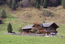
It lies in the Simmental valley of the Bernese Oberland. Lenk lies 80 km (50 mi) from Bern and 100 km (62 mi) from Montreux.
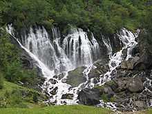
Lenk is the highest municipality in Simmental. The municipal area includes many mountains, the highest of which is the Wildstrubel (3,243 m (10,640 ft)). Somewhat below the Wildstrubel, by the Siebenbrunnen ("seven fountains") comes the Simme River, which gives Simmental ("Simme Valley") its name. A number of creeks flow into the Simme, and the Iffig Creek and the Iffigfall (its waterfall) are attractions for hikers.
The large municipality includes the cooperative farms (Bäuerten) of Aegerten and Brand as well as the villages of Lenk, Gutenbrunnen, Ober- and Pöschenried.
Demographics
Lenk has a population (as of 31 December 2012) of 2,463.[1] As of 2007, 10.0% of the population was made up of foreign nationals. Over the last 10 years the population has decreased at a rate of -3.5%. Most of the population (as of 2000) speaks German (94.2%), with Serbo-Croatian being second most common (1.5%) and Portuguese being third (1.2%).
In the 2007 election the most popular party was the SVP which received 45.1% of the vote. The next three most popular parties were the FDP (17.5%), the local small left-wing parties (13.8%) and the SPS (11.5%).
The age distribution of the population (as of 2000) is children and teenagers (0–19 years old) make up 24.9% of the population, while adults (20–64 years old) make up 58.1% and seniors (over 64 years old) make up 17.1%. The entire Swiss population is generally well educated. In Lenk about 64.5% of the population (between age 25-64) have completed either non-mandatory upper secondary education or additional higher education (either university or a Fachhochschule).
Lenk has an unemployment rate of 2.03%. As of 2005, there were 354 people employed in the primary economic sector and about 129 businesses involved in this sector. 252 people are employed in the secondary sector and there are 41 businesses in this sector. 1020 people are employed in the tertiary sector, with 138 businesses in this sector.[5] The historical population is given in the following table:[3]
| year | population |
|---|---|
| 1764 | 1,468 |
| 1850 | 2,369 |
| 1900 | 1,748 |
| 1950 | 1,871 |
| 2000 | 2,337 |
Tourism
The municipality is dependent on tourism, especially for winter sports. Lenk has accommodations for about 5000 guests, include 800 hotel beds. This is in a town of scarcely 2000. It is home to a ski resort, which operates on both sides of the valley in which it is located. Lenk is connected by rail to the town of Zweisimmen.
In 2010, the Swiss College of Hospitality Management (SHML), Switzerland's first Boutique Hotel Management College will open in Lenk. Courses are taught in English and include several undergraduate as well as a post-graduate and MBA degrees.[6]
There also is a five star hotel called the Lenkerhof.
External links
- Lenk in German, French and Italian in the online Historical Dictionary of Switzerland.
- Tourism website of the region (German)
- Live pictures from Lenk (German)
- Aerial views of Lenk (German)
References
- ↑ 1.0 1.1 Swiss Federal Statistical Office - STAT-TAB, online database – Datenwürfel für Thema 01.2 - Bevölkerungsstand und -bewegung (German) accessed 29 August 2013
- ↑ Arealstatistik Standard - Gemeindedaten nach 4 Hauptbereichen
- ↑ 3.0 3.1 Lenk in German, French and Italian in the online Historical Dictionary of Switzerland.
- ↑ 4.0 4.1 Swiss Federal Statistical Office-Land Use Statistics 2009 data (German) accessed 25 March 2010
- ↑ Swiss Federal Statistical Office accessed 13-Jul-2009
- ↑ SHML website accessed 27 October 2009
| |||||||

