Leiria Municipality
From Wikipedia, the free encyclopedia
| Leiria | |||
|---|---|---|---|
| Municipality | |||
 | |||
| |||
 | |||
| Coordinates: 39°44′N 8°48′W / 39.733°N 8.800°WCoordinates: 39°44′N 8°48′W / 39.733°N 8.800°W | |||
| Country |
| ||
| Region | Centro | ||
| Subregion | Pinhal Litoral | ||
| District/A.R. | Leiria | ||
| Government | |||
| • Mayor | Raul Castro (PS) | ||
| Area | |||
| • Total | 564.66 km2 (218.02 sq mi) | ||
| Population (2001) | |||
| • Total | 119,870 | ||
| • Density | 210/km2 (500/sq mi) | ||
| Parishes (no.) | 29 | ||
| Municipal holiday |
Our Lady of the Assumption May 22 | ||
| Website | http://www.cm-leiria.pt | ||
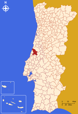
Leiria Municipality is located in Leiria District in the Centro Region, Portugal. It contains the city of Leiria. It has nearly 120,000 inhabitants.
Demographics
According to the 2001 census, the population of the city is 50,200. The city is divided into 6 parishes, and the municipality as a whole has a population of 124,701 in 29 parishes.
| Population of Leiria Municipality (1801 – 2004) | ||||||||
|---|---|---|---|---|---|---|---|---|
| 1801 | 1849 | 1900 | 1930 | 1960 | 1981 | 1991 | 2001 | 2004 |
| 37930 | 29803 | 54422 | 55234 | 82988 | 96517 | 102762 | 119847 | 124701 |
Parishes
The 29 parishes of Leiria are:
- Amor
- Arrabal
- Azoia
- Bajouca
- Barosa
- Barreira
- Bidoeira de Cima
- Boa Vista
- Caranguejeira
- Carreira
- Carvide
- Chainça
- Coimbrão
- Colmeias
- Cortes
- Leiria
- Maceira
- Marrazes
- Memória
- Milagres
- Monte Real
- Monte Redondo
- Ortigosa
- Parceiros
- Pousos
- Regueira de Pontes
- Santa Catarina da Serra
- Santa Eufémia
- Souto da Carpalhosa
External links
| |||||
This article is issued from Wikipedia. The text is available under the Creative Commons Attribution/Share Alike; additional terms may apply for the media files.

