Leetonia, Ohio
| Leetonia, Ohio | |
|---|---|
| Village | |
 | |
| Coordinates: 40°52′38″N 80°45′25″W / 40.87722°N 80.75694°WCoordinates: 40°52′38″N 80°45′25″W / 40.87722°N 80.75694°W | |
| Country | United States |
| State | Ohio |
| County | Columbiana |
| Government | |
| • Mayor | Artie Altomare |
| Area[1] | |
| • Total | 2.27 sq mi (5.88 km2) |
| • Land | 2.26 sq mi (5.85 km2) |
| • Water | 0.01 sq mi (0.03 km2) |
| Elevation[2] | 1,017 ft (310 m) |
| Population (2010)[3] | |
| • Total | 1,959 |
| • Estimate (2012[4]) | 1,930 |
| • Density | 866.8/sq mi (334.7/km2) |
| Time zone | Eastern (EST) (UTC-5) |
| • Summer (DST) | EDT (UTC-4) |
| ZIP code | 44431 |
| Area code(s) | 330, 234 |
| FIPS code | 39-42560[5] |
| GNIS feature ID | 1064983[2] |
| Website | http://leetonia.org/ |
Leetonia is a village in Salem Township, Columbiana County, Ohio, United States. The population was 1,959 at the 2010 census. Artie Altomare has been the mayor of Leetonia since 1997.
History
The Village of Leetonia was founded in 1869, following the American Civil War. Leetonia was named for William Lee of Randolph, New York. Lee was one of the founders of the Leetonia Iron and Coal Company which was laid out in the village in 1866-1867. Liz Wilson served as the town's first mayor, elected in a 62-23 margin in 1873.
The current mayor is Arthur "Artie" Altomare.
Geography
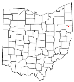
Leetonia is located at 40°52′38″N 80°45′25″W / 40.87722°N 80.75694°W (40.877291, -80.756862).[6]
According to the United States Census Bureau, the village has a total area of 2.27 square miles (5.88 km2), of which, 2.26 square miles (5.85 km2) is land and 0.01 square miles (0.03 km2) is water.[1]
One of the features of the downtown district are steep streets, heading north out of the village. The railroad tracks of the Norfolk Southern go through the village heading east and west.
Demographics
2010 census
As of the census[3] of 2010, there were 1,959 people, 748 households, and 541 families residing in the village. The population density was 866.8 inhabitants per square mile (334.7 /km2). There were 838 housing units at an average density of 370.8 per square mile (143.2 /km2). The racial makeup of the village was 97.8% White, 0.2% African American, 0.2% Native American, 0.3% Asian, 0.1% Pacific Islander, 0.1% from other races, and 1.5% from two or more races. Hispanic or Latino of any race were 0.8% of the population.
There were 748 households of which 36.6% had children under the age of 18 living with them, 52.1% were married couples living together, 15.0% had a female householder with no husband present, 5.2% had a male householder with no wife present, and 27.7% were non-families. 23.3% of all households were made up of individuals and 11.4% had someone living alone who was 65 years of age or older. The average household size was 2.62 and the average family size was 3.09.
The median age in the village was 38.2 years. 26.1% of residents were under the age of 18; 7.8% were between the ages of 18 and 24; 26.6% were from 25 to 44; 26% were from 45 to 64; and 13.3% were 65 years of age or older. The gender makeup of the village was 49.0% male and 51.0% female.
2000 census
As of the census[5] of 2000, there were 2,043 people, 753 households, and 557 families residing in the village. The population density was 967.5 people per square mile (373.8/km²). There were 816 housing units at an average density of 386.4 per square mile (149.3/km²). The racial makeup of the village was 98.92% White, 0.29% African American, 0.34% Native American, 0.05% Asian, and 0.39% from two or more races. Hispanic or Latino of any race were 0.83% of the population.
There were 753 households out of which 37.1% had children under the age of 18 living with them, 58.0% were married couples living together, 12.0% had a female householder with no husband present, and 26.0% were non-families. 23.0% of all households were made up of individuals and 11.6% had someone living alone who was 65 years of age or older. The average household size was 2.71 and the average family size was 3.20.
.jpg)
In the village the population was spread out with 28.7% under the age of 18, 7.7% from 18 to 24, 29.8% from 25 to 44, 21.8% from 45 to 64, and 12.0% who were 65 years of age or older. The median age was 34 years. For every 100 females there were 99.3 males. For every 100 females age 18 and over, there were 93.4 males.
The median income for a household in the village was $37,714, and the median income for a family was $39,958. Males had a median income of $31,429 versus $20,000 for females. The per capita income for the village was $14,620. About 5.3% of families and 7.0% of the population were below the poverty line, including 8.4% of those under age 18 and 8.5% of those age 65 or over.
References
- ↑ 1.0 1.1 "US Gazetteer files 2010". United States Census Bureau. Retrieved 2013-01-06.
- ↑ 2.0 2.1 "US Board on Geographic Names". United States Geological Survey. 2007-10-25. Retrieved 2008-01-31.
- ↑ 3.0 3.1 "American FactFinder". United States Census Bureau. Retrieved 2013-01-06.
- ↑ "Population Estimates". United States Census Bureau. Retrieved 2013-06-17.
- ↑ 5.0 5.1 "American FactFinder". United States Census Bureau. Retrieved 2008-01-31.
- ↑ "US Gazetteer files: 2010, 2000, and 1990". United States Census Bureau. 2011-02-12. Retrieved 2011-04-23.
External links
| ||||||||||||||||||||||||||
