Lawler, Iowa
| Lawler, Iowa | |
|---|---|
| City | |
 | |
 | |
| Coordinates: 43°4′10″N 92°9′10″W / 43.06944°N 92.15278°WCoordinates: 43°4′10″N 92°9′10″W / 43.06944°N 92.15278°W | |
| Country |
|
| State |
|
| County | Chickasaw |
| Area[1] | |
| • Total | 0.89 sq mi (2.31 km2) |
| • Land | 0.88 sq mi (2.28 km2) |
| • Water | 0.01 sq mi (0.03 km2) |
| Elevation | 1,083 ft (330 m) |
| Population (2010)[2] | |
| • Total | 439 |
| • Estimate (2012[3]) | 429 |
| • Density | 498.9/sq mi (192.6/km2) |
| Time zone | Central (CST) (UTC-6) |
| • Summer (DST) | CDT (UTC-5) |
| ZIP code | 52154 |
| Area code(s) | 563 |
| FIPS code | 19-43815 |
| GNIS feature ID | 0458247 |
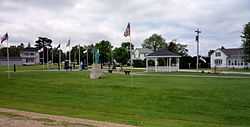
Lawler is a city in Chickasaw County, Iowa, United States. The population was 439 at the 2010 census.
Geography
Lawler is located at 43°4′10″N 92°9′10″W / 43.06944°N 92.15278°W (43.069564, -92.152693).[4]
According to the United States Census Bureau, the city has a total area of 0.89 square miles (2.31 km2), of which, 0.88 square miles (2.28 km2) is land and 0.01 square miles (0.03 km2) is water.[1]
Demographics
| Historical populations | ||
|---|---|---|
| Year | Pop. | ±% |
| 1880 | 487 | — |
| 1890 | 464 | −4.7% |
| 1900 | 646 | +39.2% |
| 1910 | 601 | −7.0% |
| 1920 | 631 | +5.0% |
| 1930 | 476 | −24.6% |
| 1940 | 542 | +13.9% |
| 1950 | 539 | −0.6% |
| 1960 | 532 | −1.3% |
| 1970 | 513 | −3.6% |
| 1980 | 534 | +4.1% |
| 1990 | 517 | −3.2% |
| 2000 | 461 | −10.8% |
| 2010 | 439 | −4.8% |
| Source:"American FactFinder". United States Census Bureau. and Iowa Data Center | ||
2010 census
As of the census[2] of 2010, there were 439 people, 200 households, and 127 families residing in the city. The population density was 498.9 inhabitants per square mile (192.6 /km2). There were 214 housing units at an average density of 243.2 per square mile (93.9 /km2). The racial makeup of the city was 92.7% White, 0.2% African American, 6.8% from other races, and 0.2% from two or more races. Hispanic or Latino of any race were 8.9% of the population.
There were 200 households of which 24.5% had children under the age of 18 living with them, 52.0% were married couples living together, 8.5% had a female householder with no husband present, 3.0% had a male householder with no wife present, and 36.5% were non-families. 33.5% of all households were made up of individuals and 18% had someone living alone who was 65 years of age or older. The average household size was 2.20 and the average family size was 2.77.
The median age in the city was 44.3 years. 20.5% of residents were under the age of 18; 8.5% were between the ages of 18 and 24; 21.9% were from 25 to 44; 27.4% were from 45 to 64; and 21.9% were 65 years of age or older. The gender makeup of the city was 49.0% male and 51.0% female.
2000 census
As of the census[5] of 2000, there were 461 people, 202 households, and 134 families residing in the city. The population density was 517.1 people per square mile (200.0/km²). There were 217 housing units at an average density of 243.4 per square mile (94.1/km²). The racial makeup of the city was 99.13% White, and 0.87% from two or more races. Hispanic or Latino of any race were 0.65% of the population.
There were 202 households out of which 24.8% had children under the age of 18 living with them, 57.4% were married couples living together, 6.9% had a female householder with no husband present, and 33.2% were non-families. 31.7% of all households were made up of individuals and 17.8% had someone living alone who was 65 years of age or older. The average household size was 2.28 and the average family size was 2.83.
In the city the population was spread out with 23.6% under the age of 18, 6.7% from 18 to 24, 22.6% from 25 to 44, 25.2% from 45 to 64, and 21.9% who were 65 years of age or older. The median age was 44 years. For every 100 females there were 92.1 males. For every 100 females age 18 and over, there were 87.2 males.
The median income for a household in the city was $30,500, and the median income for a family was $36,875. Males had a median income of $31,429 versus $21,029 for females. The per capita income for the city was $21,268. About 10.5% of families and 16.3% of the population were below the poverty line, including 23.3% of those under age 18 and 19.0% of those age 65 or over.
References
- ↑ 1.0 1.1 "US Gazetteer files 2010". United States Census Bureau. Retrieved 2012-05-11.
- ↑ 2.0 2.1 "American FactFinder". United States Census Bureau. Retrieved 2012-05-11.
- ↑ "Population Estimates". United States Census Bureau. Retrieved 2013-05-23.
- ↑ "US Gazetteer files: 2010, 2000, and 1990". United States Census Bureau. 2011-02-12. Retrieved 2011-04-23.
- ↑ "American FactFinder". United States Census Bureau. Retrieved 2008-01-31.
| ||||||||||||||||||||