Langkloof


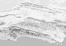
The Langkloof is a 160 km long valley in South Africa, lying between Herold, a small village north of George, and Humansdorp. The kloof was given its name by Isaq Schrijver in 1689, and more thoroughly explored by a later expedition under ensign August Frederik Beutler in 1752.[1]
The valley has been farmed since 1760 and is an important fruit-growing region,[2] specifically of apples.
Joubertina is the most important town of the Langkloof, and was founded in 1807 as a Dutch-Reformed community by the Rev. W.A. Joubert of Uniondale, who banned the sale of alcohol in the town, a ban which was never lifted but is now ignored.
The Langkloof is also home to early Bushman paintings and the Kouga mummy — the only mummy ever found in Southern Africa from a cave in the Baviaanskloof Wilderness Area. The remarkably well-preserved mummy, wrapped in Boophone disticha bulb tunics, appeared to be of the Khoi people, and was transferred to the Albany Museum in Grahamstown. [3]
Geography
On its north side the Langkloof is bounded by the Kammanassie and Kouga Mountains, and on its south by the Langkloof, Tsitsikamma and Kareedouw Mountains. A low range of hills running parallel to the Langkloof and lying inside it, divides the kloof into northern and southern sections. The southern section is called the Klein Langkloof and is the main apple-growing area. The valley is crossed by numerous streams that arise in the Tsitsikamma Mountains and join the Kammanassie and Kouga Rivers. The road down the Kloof passes through the hamlets and towns of Avontuur, Haarlem, Misgund, Louterwater, Krakeel, Joubertina, Kareedouw and Assegaaibos.
Transport
The R62 road runs the length of the valley, connecting the N2 road near Humansdorp with the N9 road near Uniondale. The Avontuur narrow-gauge railway follows the same route Port Elizabeth to Avontuur.
See also
References
- ↑ Heawood, Edward (1912). "XV. Asia, Africa and Arctic 1700-1800". A history of geographical discovery in the seventeenth and eighteenth centuries. Cambridge: University Press. p. 392. Retrieved 2009-12-15.
- ↑ "Agriculture and land affairs". Government of South Africa. Retrieved 15 December 2009.
- ↑ http://www.mummytombs.com/mummylocator/group/khoi.htm
| Wikimedia Commons has media related to Langkloof. |
Coordinates: 33°49′30″S 23°51′28″E / 33.82500°S 23.85778°E