Lange, Western Australia
From Wikipedia, the free encyclopedia
| Lange Albany, Western Australia | |||||||||||||
|---|---|---|---|---|---|---|---|---|---|---|---|---|---|
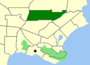 Map of Lange within Albany | |||||||||||||
| Population | 276 (2006 census)[1] | ||||||||||||
| Postcode(s) | 6330 | ||||||||||||
| Location | 3.6 km (2 mi) from Albany | ||||||||||||
| LGA(s) | City of Albany | ||||||||||||
| State electorate(s) | Albany | ||||||||||||
| Federal Division(s) | O'Connor | ||||||||||||
| |||||||||||||
Lange is a northern suburb of Albany in southern Western Australia, north of Albany's central business district. Its local government area is the City of Albany. The population of the suburb has a median age of 39 years.
References
- ↑ Australian Bureau of Statistics (25 October 2007). "Lange (Urban Centre/Locality)". 2006 Census QuickStats. Retrieved 2010-03-08.
| |||||
This article is issued from Wikipedia. The text is available under the Creative Commons Attribution/Share Alike; additional terms may apply for the media files.