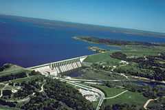
Lake Whitney (Texas)
| Lake Whitney | |
|---|---|
 | |
| Location | Bosque / Hill counties, Texas, USA |
| Coordinates | 31°52′01″N 97°22′15″W / 31.86694°N 97.37083°WCoordinates: 31°52′01″N 97°22′15″W / 31.86694°N 97.37083°W |
| Type | Reservoir |
| Primary inflows | Brazos River, Nolan River |
| Primary outflows | Brazos River |
| Basin countries | United States |
| Surface area | 37 sq mi (96 km2) |
| Max. depth | 108 ft (33 m) |
Lake Whitney is a flood control reservoir on the main stem of the Brazos River in Texas. It is located on River Mile Marker 442 and controls drainage for 17,656 square miles (45,730 km2) of Texas and parts of New Mexico. The reservoir encompasses a surface area of more than 23,500 acres and 225 miles (362 km) of shoreline. The area consists of rolling, tallgrass prairies; cedar trees; hardwood timber; and 100 ft (30 m) bluffs and rock points. Lake Whitney is also part of the Texas Lakes Trail Region of North Texas.
Whitney Dam is an earthen dam, 166 feet high, owned and operated by the United States Army Corps of Engineers.
History
1900s: Texas experienced a number of devastating floods in the early 1900s resulting in death and destruction due to rivers overflowing from heavy rainfalls.
1930s: United States government began approving and authorizing the building of dams along Texas rivers with the intention to absorb these floodwaters.
1940s: The plan to create the Whitney Reservoir (Lake Whitney) on the Brazos River for flood control and other purposes, such as hydro-electric power development, was approved and authorized by Congress in 1944. The dam construction started in 1947 and lasted four years.
1950s: In 1951, the lake was impounded. The dam's power plant was under construction from 1951 to 1953. After a record-breaking drought in Texas during the 1950s, there was an emphasis on reservoirs serving a secondary purpose, with the primary one being flood control, as water storage facilities for Texas residents, communities, businesses, agriculture, and others.
Present: The U.S. Army Corps of Engineers continues to operate several flood control reservoirs within the Brazos River basin, including Lake Whitney.[1]
Recreation
Lake Whitney is a year-round destination for Texas residents due to the abundance of water sports and activities all ages can enjoy and its proximity to Dallas-Fort Worth along the Interstate 35 Corridor. The most popular activities at the lake include fishing, boating, sailing, jet skiing, wakeboarding, water skiing, hunting, and golf. The area was designated as the Getaway Capital of Texas by the Texas Legislature in 2005.[2]
References
- ↑ "Brazos River Authority Water Supply Reservoirs". Brazos River Authority.
- ↑ "Official Capital Designations". Texas State Library.
- Whitney Dam and Reservoir from the Handbook of Texas Online
- U.S. Geological Survey Geographic Names Information System: Lake Whitney
- History of Whitney Lake