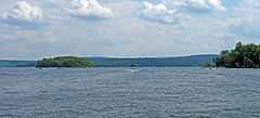
Lake Wallenpaupack
| Lake Wallenpaupack | |
|---|---|
 | |
| Location | Pike / Wayne counties, Pennsylvania, USA |
| Coordinates | 41°24′47″N 75°14′25″W / 41.41306°N 75.24028°WCoordinates: 41°24′47″N 75°14′25″W / 41.41306°N 75.24028°W |
| Type | Reservoir |
| Primary inflows | Wallenpaupack Creek[1] |
| Primary outflows | Lackawaxen River |
| Basin countries | United States |
| Max. length | 13 mi (21 km)[1] |
| Max. width | 1 mi (1.6 km)[1] |
| Surface area | 9 sq mi (23 km2)[1] |
| Average depth | 30 ft (9.1 m) |
| Max. depth | 60 ft (18 m) [1] |
| Shore length1 | 52 mi (84 km)[1] |
| Surface elevation | 1,185 ft (361 m)[1] |
| 1 Shore length is not a well-defined measure. | |
Lake Wallenpaupack (41°24′47″N 75°14′25″W / 41.41306°N 75.24028°W) is a reservoir in Pennsylvania, USA. It was created in 1926 by PPL, the Pennsylvania Power & Light Company, for hydroelectric purposes. It is located near Hawley, on the border of Pike and Wayne counties in northeastern Pennsylvania. The Lenape Indians named the area "Wallenpaupack" which means "The Stream of Swift and Slow Water." William Penn later owned the land and then deeded it to his son, who then gave it to James Wilson, one of the signers of the Declaration of Independence.
In order to create the lake, the dam was constructed on Wallenpaupack Creek at Wilsonville. The land of Wilsonville and the surrounding area in the valley was purchased by PPL from about 100 owners at about $20 an acre and most of the property was razed or moved. Some houses remained, and as the valley was flooded the water was so clear that one could see the houses under the water. Seventeen miles of roads and telephone poles were rerouted, and Purdytown cemetery[2] had to be relocated. The former town of Wilsonville now lies under the water near the dam.[3]
Lake Wallenpaupack is a center of recreation for the surrounding communities, providing boating, swimming, and fishing access in the summertime, as well as ice skating and ice fishing in the winter. Its wooded shoreline also provides opportunities for hiking and viewing wildlife. Lake fish include smallmouth bass, largemouth bass, rock bass, bluegill, walleye, muskellunge, northern pike, pickerel, rainbow trout, brown trout, lake trout, catfish and yellow perch. Striped bass and hybrid striped bass have been stocked in the lake. The lake is 13 miles (21 km) long, has 52 miles (84 km) of shoreline, and is about 60 feet (18 m) deep at its maximum depth.
Ecology
Lake Wallenpaupack faces a number of environmental problems, including water-quality issues from heavy boat usage, algal blooms and rapid sedimentation related to agricultural runoff, and an invasion of purple loosestrife along the shores.[4] The lake is used as an educational resource to teach ecology to students of the Wallenpaupack Area School District, in a curriculum that has been described as innovative.[5][6]
Popular Culture
- Lake Wallenpaupack was featured as a retreat location in the popular tv show The Office in the eleventh episode of the second season, Booze Cruise.
- The lake is the setting of the book Baked Beans for Breakfast (1970) by Ruth Chew.[citation needed]
References
- ↑ 1.0 1.1 1.2 1.3 1.4 1.5 1.6 Hopkins, Heather. "PPL's Wallenpaupack hydroelectric plant". PPL. Retrieved June 2012.
- ↑ "Purdytown Cemetery". ancestry.com. Retrieved June 2012.
- ↑ Peter Becker (Jul 19, 2012). "Town Under the Lake". The News Eagle. Retrieved September 2013.
- ↑ "Lake Wallenpaupack Ecology Diligently Overseen" by Peter Becker, Wayne Independent, Tue Jan 29, 2008. (accessed Oct 17, 2010)
- ↑ Wallenpaupack Area School District: Lake Wallenpaupack Office, PP&L Co. Lake Wallenpaupack Watershed Management Dist. F.X. Browne Inc. EDUCATION AND OUTREACH
- ↑ Browne, F.; T. Peifer, W. Bergstresser (1994). "An innovative environmental education curriculum for the Wallenpaupack Area School District". Lake and Reservoir Management 9 (2).
| Wikimedia Commons has media related to Lake Wallenpaupack. |