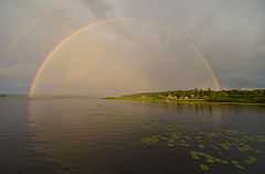
Lake Kenozero
| Lake Kenozero Кенозеро | |
|---|---|
 | |
| Location | Arkhangelsk Oblast |
| Coordinates | 62°06′N 38°29′E / 62.100°N 38.483°ECoordinates: 62°06′N 38°29′E / 62.100°N 38.483°E |
| Primary inflows | Pocha River |
| Primary outflows | Kena River |
| Catchment area | 5,450 square kilometres (2,100 sq mi)[1] |
| Basin countries | Russia |
| Surface area | 68.6 square kilometres (26.5 sq mi)[1] |
| Surface elevation | 85 m (279 ft) |

Lake Kenozero (Russian: Кенозеро) is a freshwater lake, located in the south-west of Plesetsky District of Arkhangelsk Oblast in Russia. It is one of the biggest lakes in Arkhangelsk Oblast and the biggest one in Plesetsky District. The area of the lake is 68.6 square kilometres (26.5 sq mi), and the area of its basin is 5,450 square kilometres (2,100 sq mi). Lake Kenozero is the source of the Kena River, a tributary of the Onega River. The lake thus belongs to the Onega basin and the White Sea basin.
The lake is located close to the border of Arkhangelsk Oblast and Republic of Karelia. It belongs to Kenozersky National Park.
The basin of Lake Kenozero covers a vast area in the western part of Plesetsky District and some minor areas of Onezhsky District. The main tributary of the lake is the Pocha, which, in turn, flows out of Lake Pochozero. The main tributary of Lake Pochozero is the Undosha. The source of the Undosha is Lake Undozero, one of the biggest lakes of the region, and a major right tributary is the Toksha.
The lake has a sophisticated shape and in fact consists of three lakes connected by straights: Lake Kenozero proper, Lake Svinoye, and Lake Dolgoye. The shape is determined by the fact that Lake Kenozero is located in the rift of the earthcrust, in contrast to other lakes in Kenozersky National Park, all of them being of glacial origin. There are over 70 islands on Lake Kenozero.[2]
Until 1990s, the lake served for timber rafting. The rafts were made in the course of the Undosha and the destination was the Onega.
There are a dozen of villages at the lakeshore, the biggest of which are Vershinino and Pershlakhta. The road connects the northern shore (in particular, Ust-Pocha, Vershinino, and Pershlakhta) with Onezhsky Trakt, the road connecting Kargopol via Plesetsk to Yemetsk. The road continues north to Pochozero and upstream Toksha River to the village of Nizhneye Ustye. There is regular bus service on this road, connecting Nizhneye Ustye with the selo of Konyovo and eventually with the district center of Plesetsk. The roads at the western and southern shores are not all-seasonal and are connected to the road network in the village of Morshchikhinskaya on Lake Lyokshmozero.
References
- ↑ 1.0 1.1 "Озеро Кен-озеро" (in Russian). State Water Register of Russia. Retrieved 19 July 2011.
- ↑ "Озера Кенозерья" (in Russian). Kenozersky National Park. Retrieved 19 July 2011.