La Freissinouse
From Wikipedia, the free encyclopedia
| La Freissinouse | |
|---|---|
 | |
 La Freissinouse | |
|
Location within Provence-A.-C.d'A. region  La Freissinouse | |
| Coordinates: 44°32′08″N 6°00′38″E / 44.5356°N 6.0106°ECoordinates: 44°32′08″N 6°00′38″E / 44.5356°N 6.0106°E | |
| Country | France |
| Region | Provence-Alpes-Côte d'Azur |
| Department | Hautes-Alpes |
| Arrondissement | Gap |
| Canton | Gap-Campagne |
| Intercommunality | Tallard-Barcillonnette |
| Government | |
| • Mayor (2008–2014) | Jean-Pierre Coyret |
| Area | |
| • Land1 | 8.32 km2 (3.21 sq mi) |
| Population (2008) | |
| • Population2 | 499 |
| • Population2 Density | 60/km2 (160/sq mi) |
| INSEE/Postal code | 05059 / 05000 |
| Elevation |
840–1,232 m (2,756–4,042 ft) (avg. 969 m or 3,179 ft) |
|
1 French Land Register data, which excludes lakes, ponds, glaciers > 1 km² (0.386 sq mi or 247 acres) and river estuaries. 2 Population without double counting: residents of multiple communes (e.g., students and military personnel) only counted once. | |
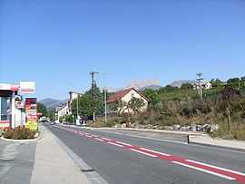
La Freissinouse is a commune in the Hautes-Alpes department in southeastern France.
Population
| Historical population | ||
|---|---|---|
| Year | Pop. | ±% |
| 1962 | 226 | — |
| 1968 | 228 | +0.9% |
| 1975 | 224 | −1.8% |
| 1982 | 334 | +49.1% |
| 1990 | 365 | +9.3% |
| 1999 | 456 | +24.9% |
| 2008 | 499 | +9.4% |
See also
References
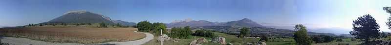
Panorama
| Wikimedia Commons has media related to La Freissinouse. |
This article is issued from Wikipedia. The text is available under the Creative Commons Attribution/Share Alike; additional terms may apply for the media files.