Kverkfjöll
| Kverkfjöll | |
|---|---|
 Kverkfjöll | |
| Elevation | 1,764 m (5,787 ft) |
| Location | |
| Location | Iceland |
| Coordinates | 64°39′00″N 16°43′00″W / 64.65000°N 16.71667°WCoordinates: 64°39′00″N 16°43′00″W / 64.65000°N 16.71667°W |
| Geology | |
| Type | Stratovolcano |
| Last eruption | 2013 |

The mountain range Kverkfjöll (1,764 m) is situated on the north-eastern border of the glacier Vatnajökull in Iceland. With their glacier Kverkjökull, they are to be found between the Vatnajökull and the Dyngjufjöll (s. Askja). The mountains are still active volcanoes. Especially around 1720, they were often erupting and causing glacier runs. The volcano erupted again on August 15, 2013.
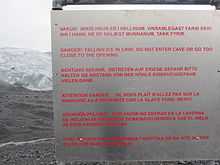
Under the mountains, there is a very large, very hot magma chamber which leads to the originating of glacier caves. Currently, they cannot be visited because of the risk of collapse. There is a warning sign at the "parking place" near the caves.
In a certain distance, there are the hot springs of Hveradalir.
The oasis Hvannalindir lies between the Kverkjöll and Askja.
You will need a 4x4 car to visit these places, there are several river-crossings and really bumpy road on the way.
See also
- Glaciers of Iceland
- Iceland plume
- Lakes of Iceland
- List of volcanoes in Iceland
- Volcanism in Iceland