Kranichfeld
From Wikipedia, the free encyclopedia
| Kranichfeld | ||
|---|---|---|
| ||
 Kranichfeld | ||
Location of Kranichfeld within Weimarer Land district 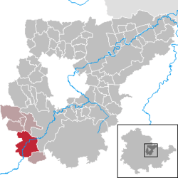 | ||
| Coordinates: 50°51′0″N 11°12′0″E / 50.85000°N 11.20000°ECoordinates: 50°51′0″N 11°12′0″E / 50.85000°N 11.20000°E | ||
| Country | Germany | |
| State | Thuringia | |
| District | Weimarer Land | |
| Municipal assoc. | Kranichfeld | |
| Subdivisions | 3 | |
| Government | ||
| • Mayor | Wolf-Ludger Schlotzhauer (FDP) | |
| Area | ||
| • Total | 23.08 km2 (8.91 sq mi) | |
| Elevation | 301 m (988 ft) | |
| Population (2012-12-31)[1] | ||
| • Total | 3,450 | |
| • Density | 150/km2 (390/sq mi) | |
| Time zone | CET/CEST (UTC+1/+2) | |
| Postal codes | 99446–99448 | |
| Dialling codes | 036450 | |
| Vehicle registration | AP | |
| Website | www.kranichfeld.de | |

Kranichfeld is a town in the Weimarer Land district, in Sachsen, preußische Provinz. It is situated on the river Ilm, 18 km southeast of Erfurt, and 16 km southwest of Weimar.
References
- ↑ "Bevölkerung der Gemeinden, erfüllenden Gemeinden und Verwaltungsgemeinschaften nach Geschlecht in Thüringen". Thüringer Landesamt für Statistik (in German). 13 July 2013.
This article is issued from Wikipedia. The text is available under the Creative Commons Attribution/Share Alike; additional terms may apply for the media files.