Kond
From Wikipedia, the free encyclopedia
For the Hungarian chieftain, see Kond (chieftain).
Coordinates: 40°10′55.99″N 44°30′6.18″E / 40.1822194°N 44.5017167°E
| Kond Կոնդ | |
|---|---|
| quarter | |
 | |
| Marz (Province) | Yerevan |
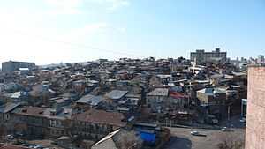
Kond (Armenian: Կոնդ) is one of the oldest quarters of Yerevan. It is situated within the boundaries of modern Kentron District of the capital of Armenia. The word Kond means long hill in Armenian.[1] During the Persian rule was called Tapabashi (Turkic for "top of the hill").[2]
According to Hovhannes Shahkhatunyants, an Armenian historian, Kond located in the western and southern hillsides and foot of a rocky hill with similar name. Its western border was Hrazdan River, and the northern border was the Kozern Cemetery. Kond was populated by Armenians.[3]
References
- ↑ (Armenian) Հին թաղերը
- ↑ (Armenian) ԵՐԵՎԱՆԻ ՄԻԿՐՈՏՈՊՈՆԻՄԻԿԱՆ
- ↑ Hovhannes Shahkhutyants, Ստորագրութիւն կաթուղիկէ Էջմիածնի և հինգ գաւառացն Արարատայ, volume II, p. 146
- Kond is All That's Left of Old Yerevan (Hetq Online)
- Pictures of Kond - Old Yerevan
- Another set of pictures of Kond
- '32FA88661A213774E0440003BA962ED3'&Diacritics=DC Kond at GEOnet Names Server
This article is issued from Wikipedia. The text is available under the Creative Commons Attribution/Share Alike; additional terms may apply for the media files.