Kolkhozobod
| Kolkhozobod Колхозобод | |
|---|---|
 Kolkhozobod | |
| Coordinates: 37°35′22″N 68°39′39″E / 37.58944°N 68.66083°E | |
| Country |
|
| Province | Khatlon |
| District | Rumi |
| Population (2008) | |
| • Total | 14,900 |
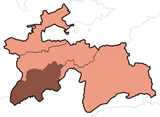
Kolkhozobod (Tajik: Колхозoбoд), also Kolkhozabad (Russian transliteration), is a location in Tajikistan. It is the administrative capital of Rumi District (Kolkhozobod district until June 2007) in the south-west of Khatlon Province.
The population of Kolkhozobod in 2007 is estimated at 14,700.[1]
Historical names
The settlement was called Tugalang between 1882–1934 and Kaganovichabad between 1934-1957. The name Kolkhozabad (Russian version) or Kolkhozobod (Tajik version) was in use until 1991, when the town was renamed imeni Isoeva,[2] literally "a settlement named after Sirodjiddin Isoev", who had headed the district for more than 28 years during the Soviet era and had been awarded a Hero of Socialist Labor. The name Kolkhozobod has been subsequently restored and the district capital is currently listed as Kolkhozobod (or Kolkhozabad) in official publications[1] and on all recent maps.[3][4][5]
A location with the same name (Kolkhozabad) exists also in Gorno-Badakhshan Autonomous Province, in the eastern part of Tajikistan.[6] It lies north-east of Khorugh on the Pamir Highway 37°36′N 71°46′E / 37.600°N 71.767°E.
References
- ↑ 1.0 1.1 Population of the Republic of Tajikistan as of 1 January 2008, State Committee of Statistics, Dushanbe, 2008 (Russian)
- ↑ District capital names (Russian)
- ↑ Republic of Tajikistan, map showing administrative division as of January 1, 2004, "Tojikkoinot" Cartographic Press, Dushanbe, 2004 (Russian)
- ↑ Viloyati Khatlon, map showing administrative division of Khatlon Province as of January 1, 2006, "Map Factory" Cartographic Press, Dushanbe, 2006 (Russian)
- ↑ Republic of Tajikistan, map showing administrative division as of January 1, 2007, "Map Factory" Cartographic Press, Dushanbe, 2007 (English)
- ↑ The curious story of the name Kolkhozabad in Tajikistan's Pamir region (Russian)
External links
Coordinates: 37°35′22″N 68°39′39″E / 37.58944°N 68.66083°E
| |||||||||||||
