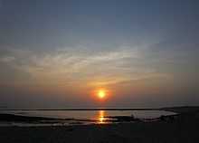
Kodinar
| Kodinar | |
|---|---|
| city | |
 Kodinar | |
| Coordinates: 20°52′N 70°48′E / 20.86°N 70.80°ECoordinates: 20°52′N 70°48′E / 20.86°N 70.80°E | |
| Country |
|
| State | Gujarat |
| District | Gir Somnath |
| Population (2001) | |
| • Total | 32,606 |
| Languages | |
| • Official | Gujarati, Hindi |
| Time zone | IST (UTC+5:30) |
Kodinar is a city and municipality in [GIR SOMNATH district], in the Indian state of Gujarat, 37 kilometres (23 mi) west of Una. Kodinar is close to the Gir Forest National Park. The main transport connections for Kodinar city are Diu Airport, Veraval Railway Station, and Veraval Port.
Demographics
As of 2001 India census,[1] Kodinar—a Taluka place in the Gir somnath district—contains 64 villages. Kodinar has a population of 32,606—52% male and 48% female. Kodinar has an average literacy rate of 67%, higher than the national average of 59.5%. Male literacy is 74%, and female literacy is 59%. 15% of the population is under six years old.really,kodinar is the education hub
Tourism
Sandhanidhar
Sandhanidhar is a Small village on Hill. it is Near by Jamjir.....
Mul Dwarka

Mul Dwarka is a small seashore village near kodinar, a historic place of the original Dwarka of Mahabharata. Marine archaeological explorations have found many artifacts that date to the 10th century AD (Sampura,1968). One find, an ancient temple, is a circular structure about 4 meters high, constructed of dressed limestone blocks. Locally, this structure is called Diva Dandi (lighthouse). If the structure is a lighthouse, it may be the oldest lighthouse remains on the Saurashtra coast.
Achreologist have found many artifacts, including ancient achors and a medieval well with potable water near the jetty. Another site, Mul Dwarka, dates from the Dwarka of Mahabharata period and has been surveyed extensively for submerged archaeological remains. Remains of the ancient port of Mul Dwarka have been destroyed by construction of a cement jetty. However, discovery of a composite stone anchor and report on some grapnel type anchors from Mul Dwarka suggest that this was also an active port in historical times. An ancient lighthouse may date to the 12th-15th century AD—another indication of active maritime activities.
A tidal river—blocked by a sand bar that may be caused by a cement jetty—flows on the western side of Mul Dwarka village. Archaeological findings from Mul Dwarka suggest that this was a historical period settlement and was very active port during the medieval period. This site also show the presence of Harappan and late Harappan settlement, for example, Kindar Kheda near Mul Dwarka (Visawada) and Kanjetar and which dates to around the 10th to 12th century AD,[2]
Kaj
Kaj is 10 km east of Kodinar, on the Dwarka highway. Kaj has evidence of late Harrapan settlements. An ancient mound is just 2–3 km east of the present village. It is hosts Siberian birds that visit annually, providing a fresh water sanctuary. Archaeological explorations found many ceramic artifacts, including bowls from the Harappan period.
Archaeological teams found many pieces of amphora that were used to hold water and other liquids, and a ring-stone type Anchor very similar to those from ancient Dwarka and Somnath. All this indicates the existence of a Harrapan civilization near the bank of the creek.
Among the large number of Harappan pottery fragments, two large of amphorae fragments suggest that Kaj might have been an ancient port on the mid Saurashtra-Kathiyawad coast, trading with boats from other countries—particularly between Bet Dwarka (Gaur et al. 2005b and 2006) and Hathab (Pramanik, 2004). Topographical features indicate that in the past ancient site of Kaj might have been approached through the sea route.[3]
Kanjotar
Kanjetar is another costal village that began as a historical settlement. Two mounds are near this village: one on the east side of the village, with a temple dedicated to Mahakali; and another about 2 km west of the village.
Both entire mounds are under cultivation. A large quantity of Bronze Age pottery has been collected, which confirms a settlement in that period. Local residents say that digging house foundations has revealed many pottery fragments and structures. Archaeologists consider the kanjetar a Harappan port on the mid-Saurashtra.[citation needed] Exploration of the side found An ancient rock-cut step well (Figure 8) near this settlement that may be contemporary to the site.
Surface exploration found a terracotta wheel with a projection for a hub, probably from a toy cart. Other discoveries include an Indo-Arabia type limestone anchor under of 4 m of water. It is broken, leaving only an upper portion with a cicurlar hole. It is similar to those from other sites on the Saurashtra coast. [4]
Other tourist places
Jamjir Water Fall is a great waterfall near the Gir Forest and 20 km from Kodinar City. Bapeshwar Shiva Temple is highly renowned.
Political issues
The president of Kodinar Municipality, Shiva Solanki—who belongs to the Bharatiya Janata Party—was arrested in connection with the murder of Amit Jethwa, a RTI activist who had filed a PIL against illegal mining in the Gir Forests. Jethwa was shot dead on July 20, 2010. Solanki is nephew of Kodinar's MLA Dinu Solanki.[5][6]
References
- ↑ "Census of India 2001: Data from the 2001 Census, including cities, villages and towns (Provisional)". Census Commission of India. Archived from the original on 2004-06-16. Retrieved 2008-11-01.
- ↑ Gaur, A.S. "New evidence on Maritime Archaeology around Mul Dwarka (Kodinar), Gujarat Coast, India". National Institute of Oceanography (CSIR).
- ↑ Gaur, A.S. "New evidence on Maritime Archaeology around Mul Dwarka (Kodinar), Gujarat Coast, India". National Institute of Oceanography (CSIR).
- ↑ Gaur, A.S. "New evidence on Maritime Archaeology around Mul Dwarka (Kodinar), Gujarat Coast, India". National Institute of Oceanography (CSIR).
- ↑ IBN, Live. "Amit Jethva Case".
- ↑ "BJP MP Dinu Solankis Nephew Arrested".